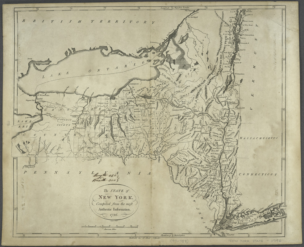
The state of New York, compiled from the most authentic information, 1796
This map is also available in American Revolutionary Geographies Online (ARGO), a collections portal especially built for material relating to the American Revolutionary War Era. Visit ARGO to learn more about this item and explore the historical geography of North America in the late eighteenth century.
Item Information
- Title:
- The state of New York, compiled from the most authentic information, 1796
- Title (alt.):
-
American atlas
- Engraver:
- Martin
- Publisher:
- Reid, John, publisher
- Name on Item:
-
Martin sculpt.
- Date:
-
[1796]
- Format:
-
Maps/Atlases
- Location:
- New York Public Library
- Collection (local):
-
Lawrence H. Slaughter Collection of English maps, charts, globes, books and atlases
- Subjects:
-
New York (State)--Maps--Early works to 1800
- Places:
-
New York
- Extent:
- 1 map ; 39 x 47 cm.
- Terms of Use:
-
No known copyright restrictions.
This work is licensed for use under a Creative Commons Attribution Non-Commercial Share Alike License (CC BY-NC-SA).

- Publisher:
-
N[ew] York :
J. Reid
- Scale:
-
Scale [ca. 1:1,325,000]
- Language:
-
English
- Catalog Record:
-
https://digitalcollections.nypl.org/items/510d47de-0ffa-a3d9-e040-e00a18064a99
- Notes:
-
Relief shown pictorially.
Differs from earlier state by corrected spelling in title.
From: The American atlas. New-York : John Reid, [1796]. [No.] 10.
- Notes (date):
-
This date is inferred.


