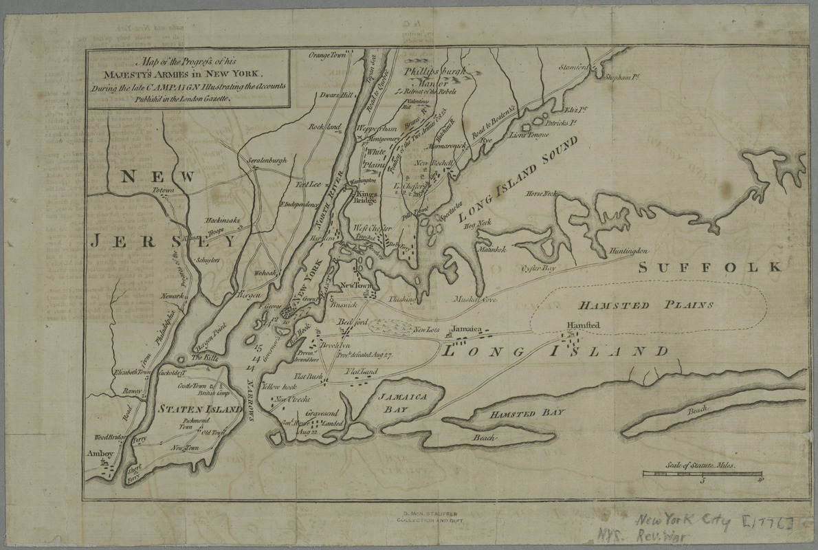
Map of the progress of His Majesty's armies in New York, during the late campaign : illustrating the accounts published in the London Gazette
This map is also available in American Revolutionary Geographies Online (ARGO), a collections portal especially built for material relating to the American Revolutionary War Era. Visit ARGO to learn more about this item and explore the historical geography of North America in the late eighteenth century.
Item Information
- Title:
- Map of the progress of His Majesty's armies in New York, during the late campaign : illustrating the accounts published in the London Gazette
- Title (uniform):
-
London gazette
Gentleman's magazine (London, England)
- Date:
-
[1776]
- Format:
-
Maps/Atlases
- Location:
- New York Public Library
- Collection (local):
-
Maps of New York City and State
- Subjects:
-
New York (State)--History--Revolution, 1775-1783--Maps--Early works to 1800
New York Region--History, Military--18th century--Maps--Early works to 1800
New York Region--Maps--Early works to 1800
- Places:
-
New York
- Extent:
- 1 map ; 20 x 32 cm.
- Terms of Use:
-
No known copyright restrictions.
This work is licensed for use under a Creative Commons Attribution Non-Commercial Share Alike License (CC BY-NC-SA).

- Publisher:
-
London :
Gentleman's magazine
- Scale:
-
Scale [ca. 1:316,800]
- Language:
-
English
- Catalog Record:
-
https://digitalcollections.nypl.org/items/510d47da-ee33-a3d9-e040-e00a18064a99
- Notes:
-
Covers New York City and vicinity, including Staten Island, nearby New Jersey, southern Westchester County, and the western half of Long Island.
Relief shown pictorially. Depths shown by soundings.
From the Gentleman's magazine, v. 46, suppl. for 1776.
- Notes (date):
-
This date is inferred.
- LCCN:
-
gm 71002200