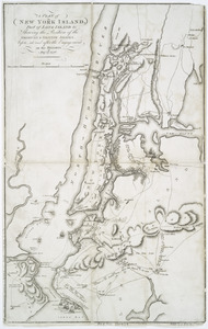
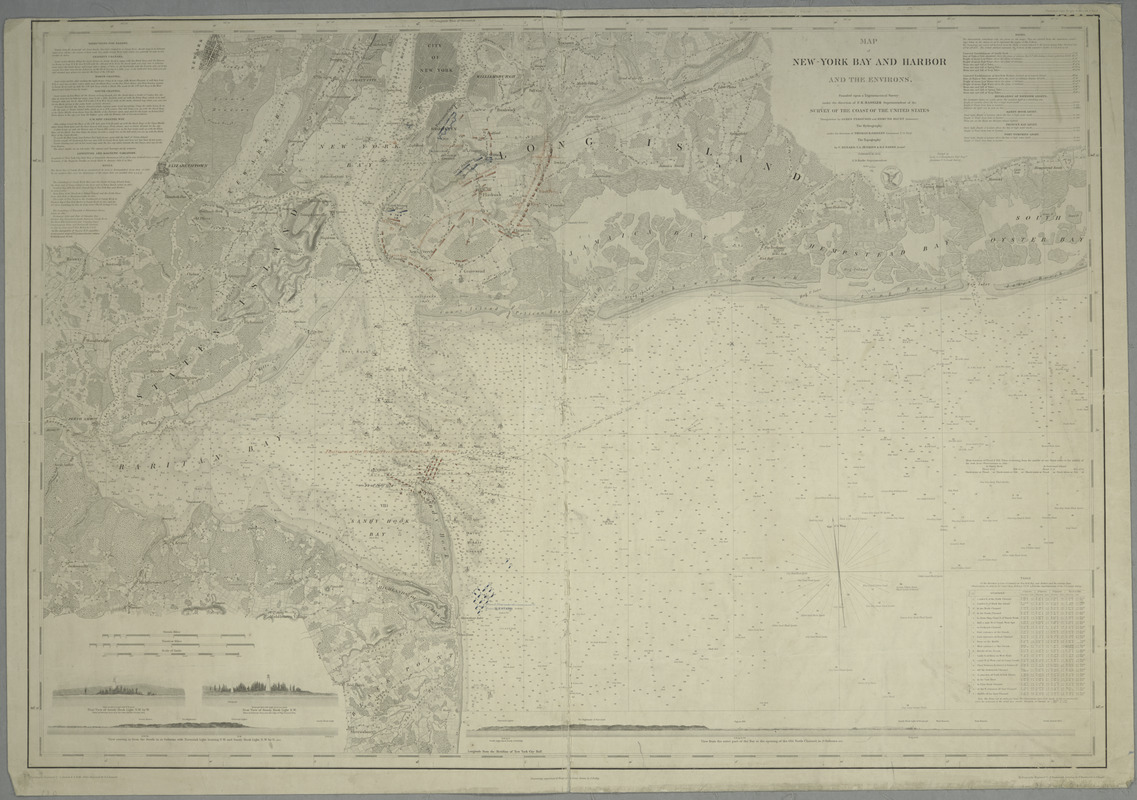
Map of New-York Bay and Harbor and the environs : [with colored manuscript additions to show positions of troops and fleets at the Battle of Long Island, 1776]
This map is also available in American Revolutionary Geographies Online (ARGO), a collections portal especially built for material relating to the American Revolutionary War Era. Visit ARGO to learn more about this item and explore the historical geography of North America in the late eighteenth century.
Item Information
- Title:
- Map of New-York Bay and Harbor and the environs : [with colored manuscript additions to show positions of troops and fleets at the Battle of Long Island, 1776]
- Creator:
- United States Coast Survey
- Contributor:
- Hassler, F. R. (Ferdinand Rudolph), 1770-1843
- Contributor:
- Ferguson, James, 1797-1867
- Contributor:
- Blunt, Edmund M.
- Contributor:
- Gedney, Thomas R.
- Contributor:
- Renard, C.
- Contributor:
- Jenkins, T. A.
- Contributor:
- Sands, B. F. (Benjamin Franklin), 1811-1883
- Contributor:
- Bache, A. D. (Alexander Dallas), 1806-1867
- Contributor:
- Humphreys, A. A. (Andrew Atkinson), 1810-1883
- Contributor:
- Siebert, Selmar
- Contributor:
- Rollé, A.
- Contributor:
- Lawson, Oscar A., 1813-1854
- Contributor:
- Farley, John, 1802 or 1803-1874
- Contributor:
- Dankworth, Frederick, approximately 1804-
- Contributor:
- Knight, J. (Jonathan), 1787-1858
- Contributor:
- Mathiot, G.
- Name on Item:
-
founded upon a trigonometrical survey under the direction of F.R. Hassler, superintendent of the Survey of the Coast of the United States ; triangulation by James Ferguson and Edmund Blunt, assistants ; the hydrography under the direction of Thomas R. Gedney, lieutenant U.S. Navy ; the topography by C. Renard, T.A. Jenkins & B.F. Sands assists. ; A.D. Bache superintendent ; verified by Lieut. A.A. Humphreys, topl. engrs. assistant, U.S. Coast Survey.
- Date:
-
1845
- Format:
-
Maps/Atlases
- Location:
- New York Public Library
- Collection (local):
-
Maps of New York City and State
- Subjects:
-
New York Harbor (N.Y. and N.J.)--Maps
Harbors--New York (State)--New York Metropolitan Area--Maps
Nautical charts--New York Harbor (N.Y. and N.J.)
Nautical charts--New York (State)--New York Metropolitan Area
Long Island, Battle of, New York, N.Y., 1776--Maps
New York (N.Y.)--History--Revolution, 1775-1783--Maps
- Places:
-
New York
- Extent:
- 1 map ; 61 x 88 cm
- Terms of Use:
-
No known copyright restrictions.
This work is licensed for use under a Creative Commons Attribution Non-Commercial Share Alike License (CC BY-NC-SA).

- Publisher:
-
[Washington, D.C.] :
Survey of the Coast of the United States
- Scale:
-
Scale 1:80,000
- Language:
-
English
- Catalog Record:
-
https://digitalcollections.nypl.org/items/510d47da-ee0a-a3d9-e040-e00a18064a99
- Notes:
-
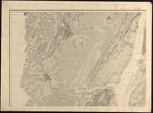
Relief shown by hachures; depths shown by soundings.
"Topography engraved by S. Siebert & A. Rolle; views engraved by O.A. Lawson ; engraving supervised & views of the coast drawn by J. Farley ; hydrography engraved by F. Dankworth ; lettering by F. Dankworth & J. Knight."
Prime meridians: New York and Greenwich.
In upper right margin: Electrotype copy no. 7, by G. Mathiot U.S.C.S.
Annotated with red and blue ink to show positions of troops and fleets at the Battle of Long Island.
Includes text, table of currents, and 4 coastal panoramas.