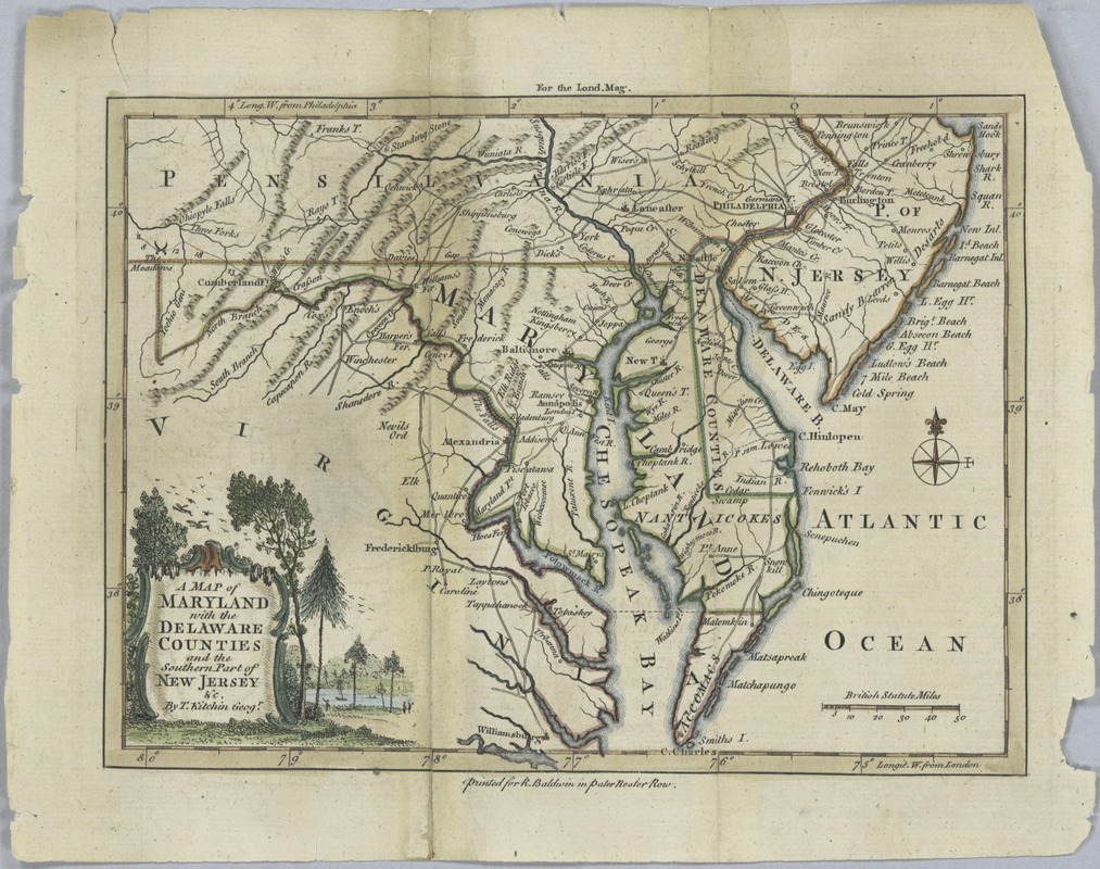
A map of Maryland with the Delaware counties and the southern part of New Jersey &c
This map is also available in American Revolutionary Geographies Online (ARGO), a collections portal especially built for material relating to the American Revolutionary War Era. Visit ARGO to learn more about this item and explore the historical geography of North America in the late eighteenth century.
Item Information
- Title:
- A map of Maryland with the Delaware counties and the southern part of New Jersey &c
- Creator:
- Kitchin, Thomas, 1718-1784
- Name on Item:
-
by T. Kitchin, geogr.
- Date:
-
[1757]
- Format:
-
Maps/Atlases
- Location:
- New York Public Library
- Collection (local):
-
Lawrence H. Slaughter Collection of English maps, charts, globes, books and atlases
- Subjects:
-
Maryland--Maps--Early works to 1800
- Places:
-
Maryland
- Extent:
- 1 map ; 17 x 23 cm.
- Terms of Use:
-
No known copyright restrictions.
This work is licensed for use under a Creative Commons Attribution Non-Commercial Share Alike License (CC BY-NC-SA).

- Publisher:
-
[London] :
R. Baldwin
- Scale:
-
Scale ca. 1:2,439,360
- Language:
-
English
- Catalog Record:
-
https://digitalcollections.nypl.org/items/510d47da-efb6-a3d9-e040-e00a18064a99
- Notes:
-
For the Lond. Mag. [August 1757].
- Notes (date):
-
This date is inferred.

![[A map of part of Pennsylvania & Maryland intended to shew, at one view, the several places proposed for opening a communication between the waters of the Delaware & Chesopeak Bays]](https://bpldcassets.blob.core.windows.net/derivatives/images/commonwealth:z603vt12v/image_thumbnail_300.jpg)


