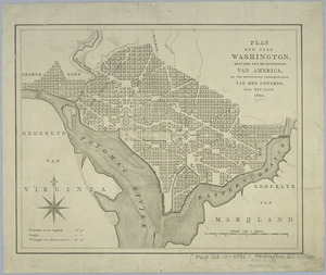
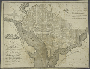
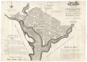
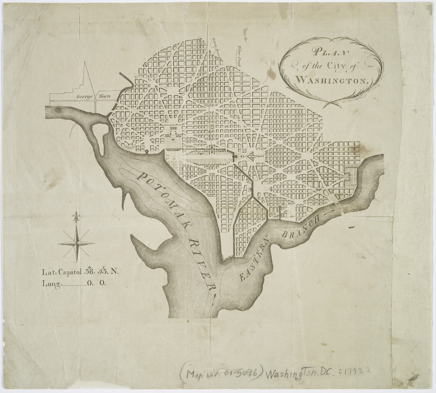
Plan of the city of Washington
This map is also available in American Revolutionary Geographies Online (ARGO), a collections portal especially built for material relating to the American Revolutionary War Era. Visit ARGO to learn more about this item and explore the historical geography of North America in the late eighteenth century.
Item Information
- Title:
- Plan of the city of Washington
- Contributor:
- Thackara & Vallance
- Name on Item:
-
Thackara & Vallance, sc.
- Date:
-
[1792?]
- Format:
-
Maps/Atlases
- Location:
- New York Public Library
- Collection (local):
-
Lawrence H. Slaughter Collection of English maps, charts, globes, books and atlases
- Subjects:
-
Washington (D.C.)--Maps--Early works to 1800
- Places:
-
Washington
- Extent:
- 1 map ; 22 x 26 cm.
- Terms of Use:
-
No known copyright restrictions.
This work is licensed for use under a Creative Commons Attribution Non-Commercial Share Alike License (CC BY-NC-SA).

- Publisher:
-
Philadelphia? :
W. Young?
- Scale:
-
Scale not given
- Language:
-
English
- Catalog Record:
-
https://digitalcollections.nypl.org/items/510d47da-f07e-a3d9-e040-e00a18064a99
- Notes:
-
Probably from the Universal asylum, and Columbian magazine, v. 4, March 1792.