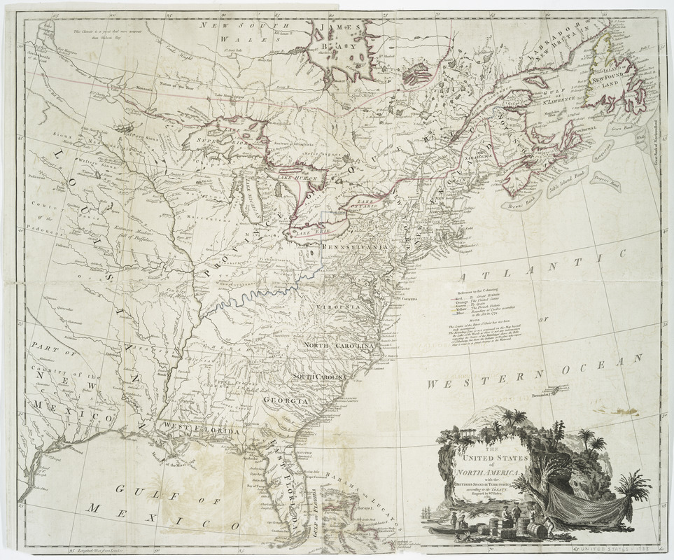
The United States of North America, with the British & Spanish territories according to the treaty
This map is also available in American Revolutionary Geographies Online (ARGO), a collections portal especially built for material relating to the American Revolutionary War Era. Visit ARGO to learn more about this item and explore the historical geography of North America in the late eighteenth century.
Item Information
- Title:
- The United States of North America, with the British & Spanish territories according to the treaty
- Creator:
- Faden, William, 1750?-1836
- Former owner:
- Streeter, Thomas W. (Thomas Winthrop), 1883-1965
- Name on Item:
-
Engrav'd by Wm. Faden.
- Date:
-
1783
- Format:
-
Maps/Atlases
- Location:
- New York Public Library
- Collection (local):
-
Maps of North America
- Subjects:
-
United States--Maps--Early works to 1800
United States--Boundaries--Maps--Early works to 1800
- Places:
-
- Extent:
- 1 map : hand col. ; 51 x 62 cm.
- Terms of Use:
-
No known copyright restrictions.
This work is licensed for use under a Creative Commons Attribution Non-Commercial Share Alike License (CC BY-NC-SA).

- Publisher:
-
London :
[William Faden]
- Scale:
-
Scale [ca. 1:6,450,000]
- Language:
-
English
- Catalog Record:
-
https://digitalcollections.nypl.org/items/510d47da-efa2-a3d9-e040-e00a18064a99
- Notes:
-
Hand colored.
Relief shown pictorially.
Prime meridian: London.
Second issue, 1783; 5 color key, 7 line note, St. Croix River detail.
Cartouche includes scene of British merchants and slaves loading a boat, waterfall, etc.
Library's copy includes manuscript annotations, verso, of former owner Thomas W. Streeter.


