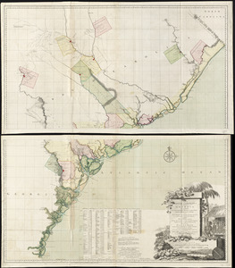
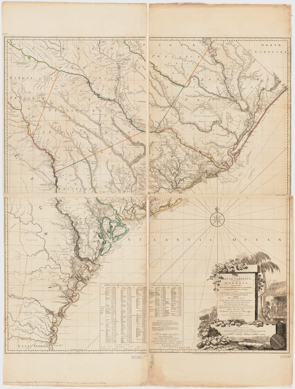
A map of South Carolina and a part of Georgia : Containing the whole sea-coast; all the islands, inlets, rivers, creeks, parishes, townships, boroughs, roads, and bridges: As also, several plantations, with their proper boundary-lines, their names, and the names of their proprietors
This map is also available in American Revolutionary Geographies Online (ARGO), a collections portal especially built for material relating to the American Revolutionary War Era. Visit ARGO to learn more about this item and explore the historical geography of North America in the late eighteenth century.
Item Information
- Title:
- A map of South Carolina and a part of Georgia : Containing the whole sea-coast; all the islands, inlets, rivers, creeks, parishes, townships, boroughs, roads, and bridges: As also, several plantations, with their proper boundary-lines, their names, and the names of their proprietors
- Creator:
- Faden, William, 1749-1836
- Contributor:
- Bull, William, 1710-1791
- Contributor:
- De Brahm, John Gerar William, 1717-approximately 1799
- Contributor:
- Stuart, John, 1718-1799
- Name on Item:
-
Composed from surveys taken by ... William Bull ... and William De Brahm ... republished with considerable additions, from the surveys made & collected by John Stuart ... by William Faden.
- Date:
-
1780
- Format:
-
Maps/Atlases
- Location:
- Harvard Library
- Collection (local):
-
Harvard Map Collection
- Subjects:
-
Real property--Georgia--Maps--Early works to 1800
Real property--South Carolina--Maps--Early works to 1800
Georgia--Administrative and political divisions--Maps--Early works to 1800
Georgia--Maps--Early works to 1800
South Carolina--Administrative and political divisions--Maps--Early works to 1800
South Carolina--Maps--Early works to 1800
- Places:
-
Georgia
South Carolina
- Extent:
- 1 map on 4 sheets. 136 x 123 cm.
- Terms of Use:
-
No known copyright restrictions.
This work is licensed for use under a Creative Commons Attribution Non-Commercial Share Alike License (CC BY-NC-SA).

- Scale:
-
Scale [ca. 1:320,000]
- Language:
-
English
- Catalog Record:
-
http://id.lib.harvard.edu/aleph/011472703/catalog
- Notes:
-
Relief shown by hachures. Depths shown by soundings.
"West longitude from London."
Includes indexes for "The names of the proprietors of land in South Carolina" and "The names of the proprietors of land in Georgia."
- LCCN:
-
74692520