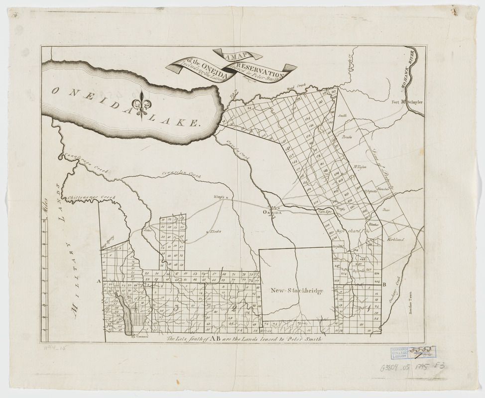
A map of the Oneida Reservation : including the lands leased to Peter Smith
This map is also available in American Revolutionary Geographies Online (ARGO), a collections portal especially built for material relating to the American Revolutionary War Era. Visit ARGO to learn more about this item and explore the historical geography of North America in the late eighteenth century.
Item Information
- Title:
- A map of the Oneida Reservation : including the lands leased to Peter Smith
- Creator:
- Fairman, Gideon, 1774-1827
- Contributor:
- Smith, Peter, 1768-1837
- Name on Item:
-
Fairman, sct, Alby.
- Date:
-
[1795?]
- Format:
-
Maps/Atlases
- Location:
- Harvard Library
- Collection (local):
-
Harvard Map Collection
- Subjects:
-
Onondaga County (N.Y.)--Maps--Early works to 1800
Oneida County (N.Y.)--Maps--Early works to 1800
Madison County (N.Y.)--Maps--Early works to 1800
Oneida Region (N.Y.)--Maps--Early works to 1800
Real property--New York (State)--Maps--Early works to 1800
Landowners--New York (State)--Maps--Early works to 1800
- Places:
-
Onondaga (county)
Oneida (county)
- Extent:
- 1 map ; 30 x 39 cm.
- Terms of Use:
-
No known copyright restrictions.
This work is licensed for use under a Creative Commons Attribution Non-Commercial Share Alike License (CC BY-NC-SA).

- Publisher:
-
[S.l.] :
[s.n.]
- Scale:
-
Scale [ca. 1:130,000]
- Language:
-
English
- Catalog Record:
-
http://id.lib.harvard.edu/aleph/009730065/catalog
- Notes:
-
Cadastral map showing property and lot lines, lot numbers, and some owners' names.
Covers Onondaga, Madison and Oneida counties, New York
Watermark: "WHATMAN"


