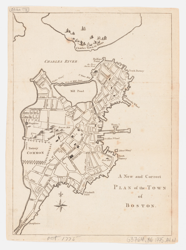
A new and correct plan of the town of Boston
This map is also available in American Revolutionary Geographies Online (ARGO), a collections portal especially built for material relating to the American Revolutionary War Era. Visit ARGO to learn more about this item and explore the historical geography of North America in the late eighteenth century.
Item Information
- Title:
- A new and correct plan of the town of Boston
- Creator:
- Aitken, Robert, 1735-1802
- Date:
-
[1775]
- Format:
-
Maps/Atlases
- Location:
- Harvard Library
- Collection (local):
-
Harvard Map Collection
- Subjects:
-
Boston (Mass.)--Maps--Early works to 1800
Fortification--Massachusetts--Boston--Maps--Early works to 1800
Boston (Mass.)--Buildings, structures, etc--Maps--Early works to 1800
- Places:
-
Suffolk (county)Boston
- Extent:
- 1 map ; 27 x 19 cm.
- Terms of Use:
-
No known copyright restrictions.
This work is licensed for use under a Creative Commons Attribution Non-Commercial Share Alike License (CC BY-NC-SA).

- Publisher:
-
London :
[s.n.]
- Scale:
-
Scale not given
- Language:
-
English
- Catalog Record:
-
http://id.lib.harvard.edu/aleph/009381627/catalog
- Notes:
-
Shows streets, wharves, fortifications, and The Common.
Relief shown pictorially.
"Charles Town in ruins" is indicated at the top.
No engraver's signature.
From: Gentleman's magazine. Vol. 45 (Oct. 1775). p. 493.
- Notes (date):
-
This date is inferred.


