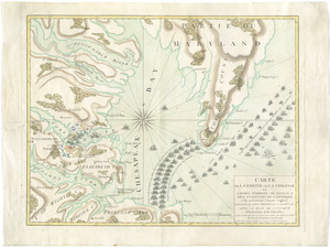
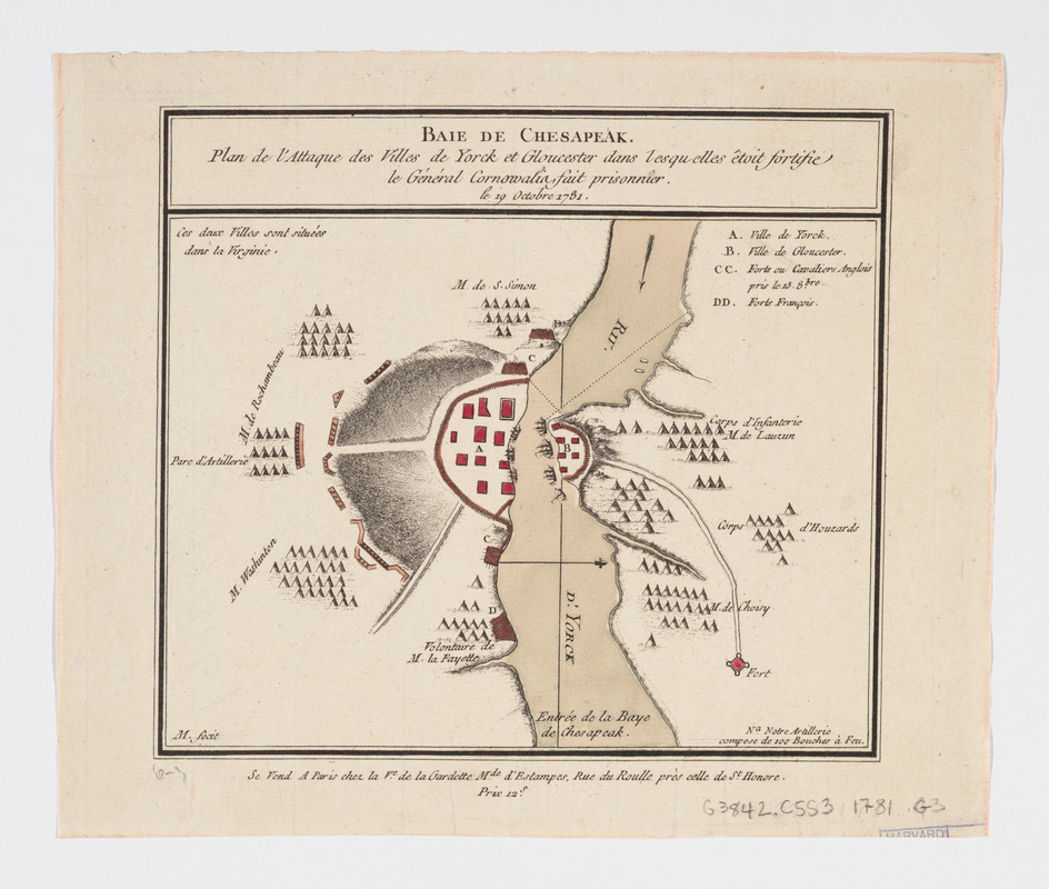
Baie de Chesapeak : plan de l'attaque des villes de Yorck et Gloucester dans lesquelles êtoit fortifie le Général Cornwalia, fait prisonner le 19 Octobre 1781
This map is also available in American Revolutionary Geographies Online (ARGO), a collections portal especially built for material relating to the American Revolutionary War Era. Visit ARGO to learn more about this item and explore the historical geography of North America in the late eighteenth century.
Item Information
- Title:
- Baie de Chesapeak : plan de l'attaque des villes de Yorck et Gloucester dans lesquelles êtoit fortifie le Général Cornwalia, fait prisonner le 19 Octobre 1781
- Creator:
- Gardette, Marie Madeleine Folleville, active 1781-1785
- Name on Item:
-
M. fecit
- Date:
-
[1781?]
- Format:
-
Maps/Atlases
- Location:
- Harvard Library
- Collection (local):
-
Harvard Map Collection
- Subjects:
-
Chesapeake Bay (Md. and Va.)--History--Revolution, 1775-1783--Maps--Early works to 1800
Yorktown (Va.)--History--Siege, 1781--Maps--Early works to 1800
Gloucester (Va.)--History--Revolution, 1775-1783--Maps--Early works to 1800
- Places:
-
Chesapeake Bay
York (county)Yorktown
Gloucester (county)Gloucester
- Extent:
- 1 map : hand col. ; 13 x 18 cm.
- Terms of Use:
-
No known copyright restrictions.
This work is licensed for use under a Creative Commons Attribution Non-Commercial Share Alike License (CC BY-NC-SA).

- Publisher:
-
Paris :
chez la Ve. de la Gardette Mde. d'Estampes, Rue du Roulle près celle de St. Honore
- Scale:
-
Scale not given
- Language:
-
French
- Catalog Record:
-
http://id.lib.harvard.edu/aleph/010094646/catalog
- Notes:
-
Shows fortifications of the French, American, and British troops.
Relief shown by hachures.
North oriented to the right.
Includes legend of fortifications.