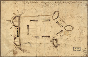
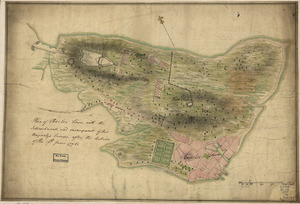
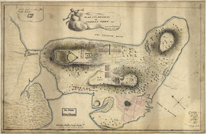
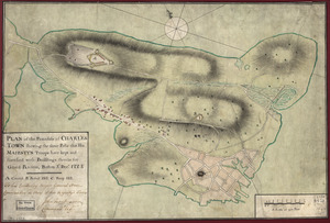
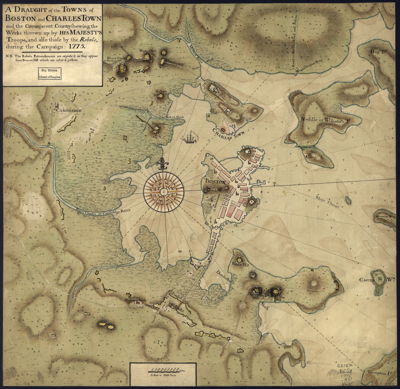
A draught of the towns of Boston and Charles Town and the circumjacent country : shewing the works thrown up by His Majesty's troops, and also those by the rebels, during the campaign: 1775
This map is also available in American Revolutionary Geographies Online (ARGO), a collections portal especially built for material relating to the American Revolutionary War Era. Visit ARGO to learn more about this item and explore the historical geography of North America in the late eighteenth century.
Item Information
- Title:
- A draught of the towns of Boston and Charles Town and the circumjacent country : shewing the works thrown up by His Majesty's troops, and also those by the rebels, during the campaign: 1775
- Creator:
- Montrésor, John, 1736-1799
- Date:
-
[1775]
- Format:
-
Maps/Atlases
Manuscripts
- Location:
- Library of Congress Geography and Map Division
- Collection (local):
-
Library of Congress Geography and Map Division
- Subjects:
-
Boston (Mass.)--History--Siege, 1775-1776--Maps, Manuscript--Early works to 1800
Fortification--Massachusetts--Boston--Maps, Manuscript--Early works to 1800
Boston (Mass.)--Buildings, structures, etc--Maps, Manuscript--Early works to 1800
- Places:
-
Suffolk (county)Boston
- Extent:
- col. map 43 x 44 cm.
- Terms of Use:
-
No known copyright restrictions.
This work is licensed for use under a Creative Commons Attribution Non-Commercial Share Alike License (CC BY-NC-SA).

- Scale:
-
Scale ca. 1:26,500
- Language:
-
English
- Catalog Record:
-
https://lccn.loc.gov/gm71000916
- Notes:
-
Manuscript, pen-and-ink and watercolor.
Watermark: J. Whatman.
Relief shown by shading. Depths shown by soundings.
"N.B. The rebels entrenchments are express'd as they appear from Beacon Hill which are color'd yellow."
- Notes (date):
-
This date is inferred.
- LCCN:
-
gm 71000916