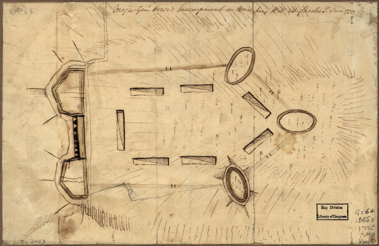
Major Genl. Howe's encampment on Bunkers Hill at Charles T : June 1775
This map is also available in American Revolutionary Geographies Online (ARGO), a collections portal especially built for material relating to the American Revolutionary War Era. Visit ARGO to learn more about this item and explore the historical geography of North America in the late eighteenth century.
Item Information
- Title:
- Major Genl. Howe's encampment on Bunkers Hill at Charles T : June 1775
- Title (alt.):
-
Bunkers Hill at Charles T
- Date:
-
[1775]
- Format:
-
Maps/Atlases
Manuscripts
- Location:
- Library of Congress Geography and Map Division
- Collection (local):
-
Library of Congress Geography and Map Division
- Subjects:
-
Boston (Mass.)--History--Siege, 1775-1776--Maps, Manuscript--Early works to 1800
Fortification--Massachusetts--Boston--Maps, Manuscript--Early works to 1800
Boston (Mass.)--Buildings, structures, etc--Maps, Manuscript--Early works to 1800
- Places:
-
Suffolk (county)Boston
- Extent:
- col. map on sheet 20 x 31 cm.
- Terms of Use:
-
No known copyright restrictions.
This work is licensed for use under a Creative Commons Attribution Non-Commercial Share Alike License (CC BY-NC-SA).

- Language:
-
English
- Catalog Record:
-
https://lccn.loc.gov/gm71002453
- Notes:
-
Manuscript, pen-and-ink and watercolor.
Relief shown by hachures.
Shows position of troops and fortifications.
Scale not given.
- Notes (date):
-
This date is inferred.
- LCCN:
-
gm 71002453