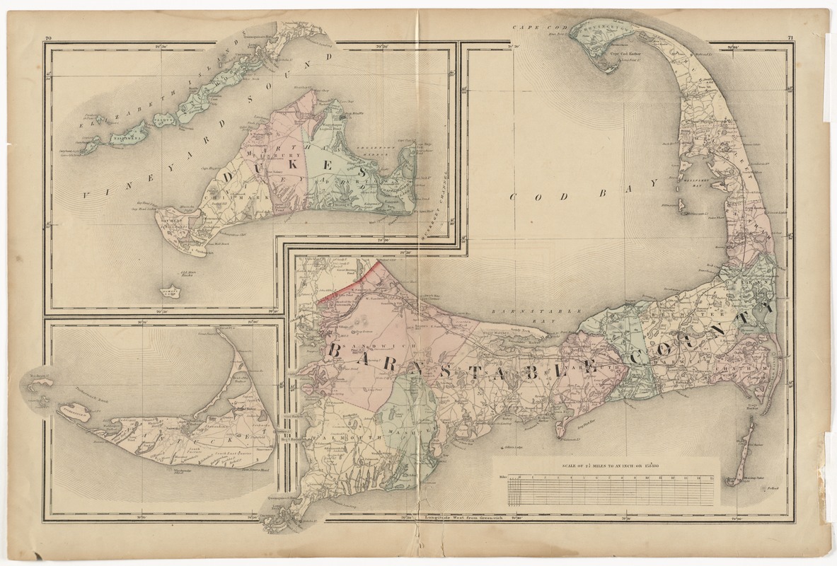
Barnstable County, Dukes County and Nantucket Island, Massachusetts
Item Information
- Title:
- Barnstable County, Dukes County and Nantucket Island, Massachusetts
- Creator:
- Walling, Henry Francis, 1825-1888
- Date:
-
[1871]
- Format:
-
Maps/Atlases
- Location:
- Phillips Academy
- Collection (local):
-
Sidney R. Knafel Map Collection at Phillips Academy, Andover MA
- Subjects:
-
Barnstable County (Mass)--Maps
Dukes County (Mass)--Maps
Martha's Vineyard (Mass)--Maps
Nantucket Island (Mass)--Maps
- Places:
-
Barnstable (county)
Dukes (county)
Nantucket (county)Nantucket Island (island)
- Extent:
- 1 map : hand col. ; 42 x 61 cm.
- Terms of Use:
-
Rights status not evaluated.
Contact host institution for more information.
- Publisher:
-
[Boston] :
[Stedman Brown & Lyon]
- Scale:
-
Scale 1:158,400. 2 1/2 miles to an in.
- Language:
-
English
- Notes:
-
Relief shown by hachures.
Shows towns, settlements, school houses, churches, roads, railroads, marshes, etc.
Pages 70-71 from Walling's Official topographical atlas of Massachusetts.
- Notes (date):
-
This date is inferred.
- Identifier:
-
1348


