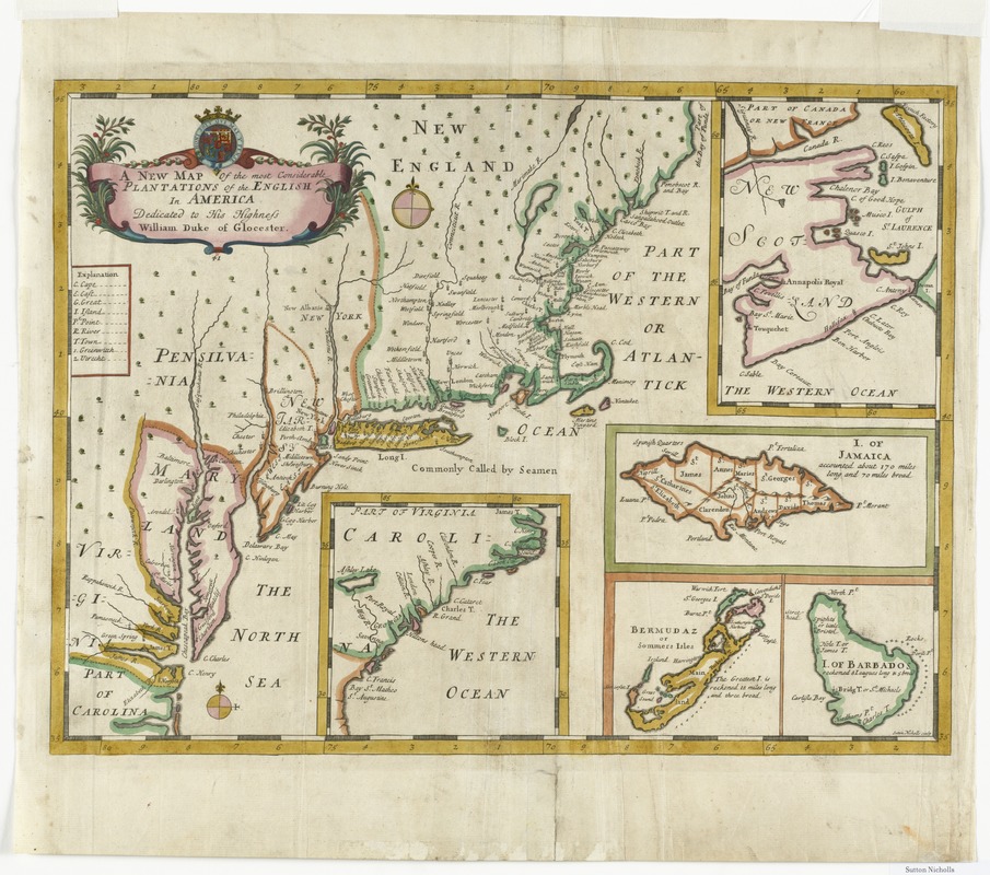
A new map of the most considerable plantations of the English in America
This map is also available in American Revolutionary Geographies Online (ARGO), a collections portal especially built for material relating to the American Revolutionary War Era. Visit ARGO to learn more about this item and explore the historical geography of North America in the late eighteenth century.
Item Information
- Title:
- A new map of the most considerable plantations of the English in America
- Creator:
- Nicholls, Sutton
- Name on Item:
-
Sutton Nicholls, sculp.
- Date:
-
[ca. 1743]
- Format:
-
Maps/Atlases
- Location:
- Phillips Academy
- Collection (local):
-
Sidney R. Knafel Map Collection at Phillips Academy, Andover MA
- Subjects:
-
North America--Maps--Early works to 1800
New England--Maps--Early works to 1800
Middle Atlantic States--Maps--Early works to 1800
- Places:
-
New England (area)
Middle Atlantic (area)
- Extent:
- 1 map : hand col. ; 34 x 46 cm.
- Terms of Use:
-
Rights status not evaluated.
Contact host institution for more information.
- Publisher:
-
[London] :
[s.n.]
- Scale:
-
Scale [ca. 1:3,500,000]
- Language:
-
English
- Notes:
-
Insets: New Scotland -- I. of Jamaica -- I. of Barbados -- Bermudaz or Sommers Isles -- Carolina.
"Dedicated to His Highness William Duke of Glocester."
State 3.
Earlier versions published in Edward Wells' A new sett of maps.
- Notes (citation):
-
Burden, P. Mapping of North America II, 773
- Identifier:
-
1327


