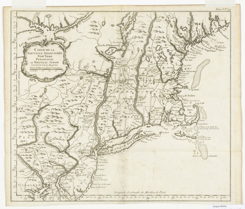
Carte de la Nouvelle Angleterre, New York, Pensilvanie et Nouveau Jersay suivant les cartes angloises
This map is also available in American Revolutionary Geographies Online (ARGO), a collections portal especially built for material relating to the American Revolutionary War Era. Visit ARGO to learn more about this item and explore the historical geography of North America in the late eighteenth century.
Item Information
- Title:
- Carte de la Nouvelle Angleterre, New York, Pensilvanie et Nouveau Jersay suivant les cartes angloises
- Creator:
- Bellin, Jacques Nicolas, 1703-1772
- Date:
-
[1764]
- Format:
-
Maps/Atlases
- Location:
- Phillips Academy
- Collection (local):
-
Sidney R. Knafel Map Collection at Phillips Academy, Andover MA
- Subjects:
-
Northeastern States--Maps--Early works to 1800
Middle Atlantic States--Maps--Early works to 1800
New England--Maps--Early works to 1800
- Places:
-
New England (area)
Middle Atlantic (area)
- Extent:
- 1 map ; 33 x 37 cm.
- Terms of Use:
-
Rights status not evaluated.
Contact host institution for more information.
- Publisher:
-
[Paris] :
[Bellin]
- Scale:
-
Scale [ca. 1:2,000,000]
- Language:
-
French
- Notes:
-
Covers the area from Penobscot Bay to Delaware Bay and west to the middle of Lake Ontario.
Shows provinces, towns and cities, forts, and few roads, the dividing line between East and West Jersey, harbors and a few navigational hazards along the coast, rivers, and relief.
Relief shown pictorially.
"Tome I, no. 29." in upper margin.
From author's Le petit atlas maritime, 1764.
- Notes (date):
-
This date is inferred.
- Notes (citation):
-
LC Maps of North America, 1750-1789, 723
- Identifier:
-
1395


