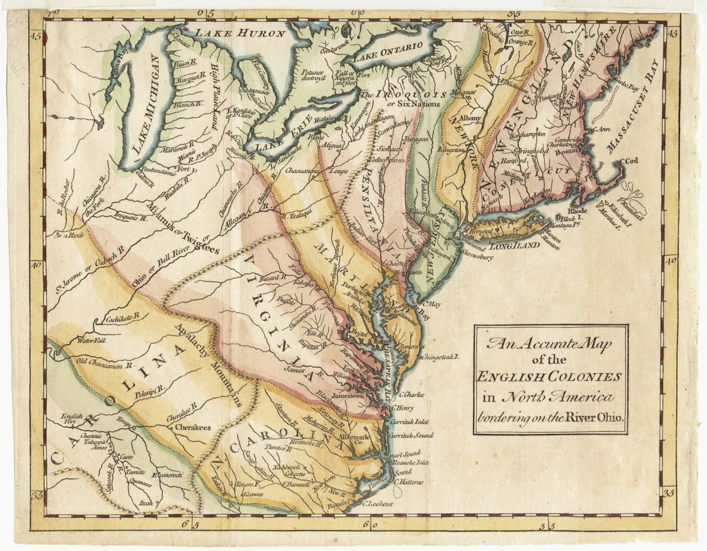
An accurate map of the English colonies in North America, bordering on the river Ohio
This map is also available in American Revolutionary Geographies Online (ARGO), a collections portal especially built for material relating to the American Revolutionary War Era. Visit ARGO to learn more about this item and explore the historical geography of North America in the late eighteenth century.
Item Information
- Title:
- An accurate map of the English colonies in North America, bordering on the river Ohio
- Date:
-
[1754]
- Format:
-
Maps/Atlases
- Location:
- Phillips Academy
- Collection (local):
-
Sidney R. Knafel Map Collection at Phillips Academy, Andover MA
- Subjects:
-
United States--Maps--Early works to 1800
- Places:
-
- Extent:
- 1 map : hand col. ; 19 x 23 cm.
- Terms of Use:
-
Rights status not evaluated.
Contact host institution for more information.
- Publisher:
-
[London] :
[s.n.]
- Scale:
-
Scale [ca. 1:6,400,000]
- Language:
-
English
- Notes:
-
Covers from Maine to South Carolina and west to Lake Michigan.
Relief shown pictorially.
Appears in Universal magazine of knowledge and pleasure, Dec., 1754, v. 15, pg. 241.
- Notes (date):
-
This date is inferred.
- Notes (citation):
-
LC maps of North America, 1750-1789, 707
- Identifier:
-
1370


