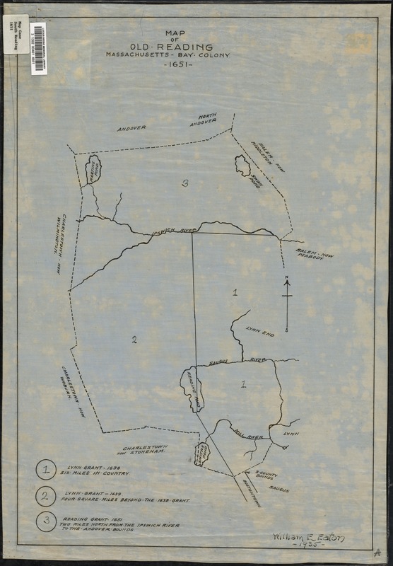
Map of old Reading, Massachusetts Bay Colony, 1651
Item Information
- Title:
- Map of old Reading, Massachusetts Bay Colony, 1651
- Creator:
- Eaton, William E.
- Date:
-
1935
- Format:
-
Maps/Atlases
- Location:
- Lucius Beebe Memorial Library
- Collection (local):
-
Lucius Beebe Memorial Library Historic Maps
- Places:
-
Middlesex (county)Reading
- Extent:
- 1 map : b&w, ink on linen ; 54 x 38 cm.
- Terms of Use:
-
No known copyright restrictions.
No known restrictions on use.
- Publisher:
-
[s.l.] :
William E. Eaton
- Scale:
-
Scale [ca. 1:42,450]
- Language:
-
English
- Notes:
-
Map depicts old Reading (what is now Reading, North Reading, and Wakefield) in 1651, showing the boundaries of the original land grants, and rivers and ponds.
- Call #:
-
Local History Map Case South Reading 1651
- Barcode:
-
31392004614651


