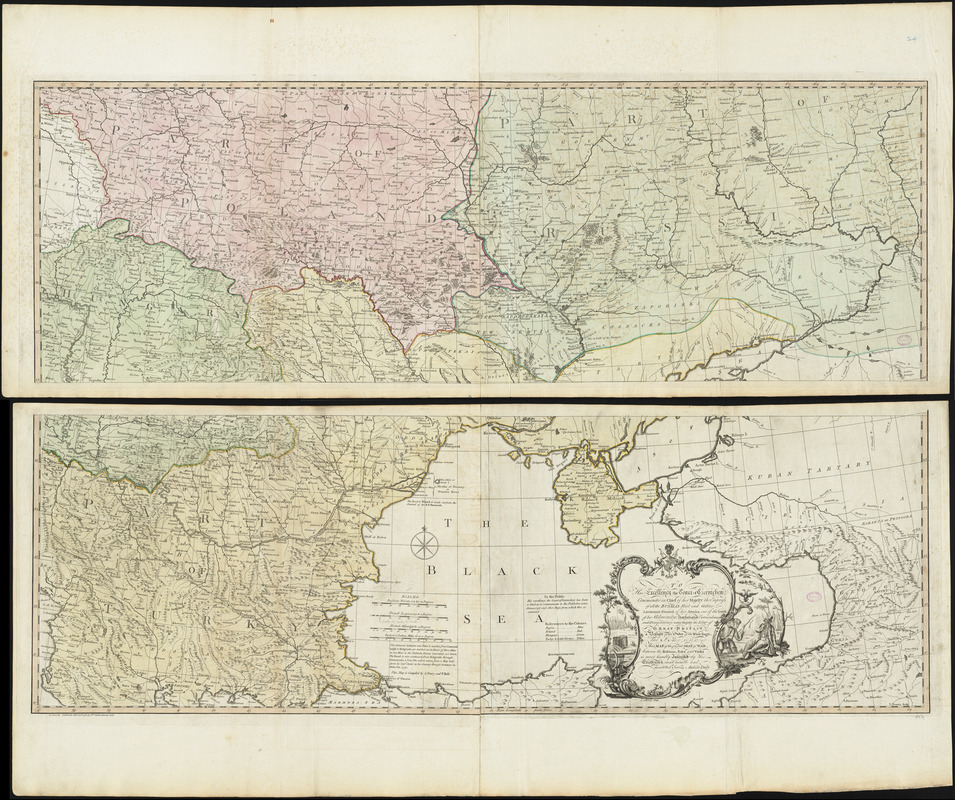
To his excellency the Count of Czernichew, Commander in Chief of her Majesty the Empress, of all the Russia's fleet and gallies, Lieutenant General of her armies, one of the Lords of her Admiralty, Ambassador extraordinary and plenipotentiary to his Majesty the King of Great Britain, a Knight of the Order of the White Eagle, and St. Ann &c. &c. &c., this map of the present seat of war, between the Russians, Poles, and Turks is most humbly inscribed by his excellency's most humble and obedt. servt
Item Information
- Title:
- To his excellency the Count of Czernichew, Commander in Chief of her Majesty the Empress, of all the Russia's fleet and gallies, Lieutenant General of her armies, one of the Lords of her Admiralty, Ambassador extraordinary and plenipotentiary to his Majesty the King of Great Britain, a Knight of the Order of the White Eagle, and St. Ann &c. &c. &c., this map of the present seat of war, between the Russians, Poles, and Turks is most humbly inscribed by his excellency's most humble and obedt. servt
- Title (alt.):
-
Map of the present seat of war, between the Russians, Poles, and Turks
This map of the present seat of war, between the Russians, Poles, and Turks
- Creator:
- Dury, Andrew
- Cartographer:
- Dury, Andrew
- Compiler:
- Bell, Peter
- Engraver:
- Bowen, Thomas, -1790
- Engraver:
- Caldwall, James
- Contributor:
- Chernyshov, Ivan Grigoryevich, 1726-1797
- Publisher:
- Faden, William, 1749-1836
- Artist:
- Tueur, T.W.
- Name on Item:
-
Andrew Dury ; T. Bowen sculp.
- Date:
-
1783
- Format:
-
Maps/Atlases
- Location:
-
Boston Public Library
Norman B. Leventhal Map Center - Collection (local):
-
Norman B. Leventhal Map Center Collection
- Subjects:
-
Russo-Turkish War, 1787-1792--Maps--Early works to 1800
Black Sea--Maps--Early works to 1800
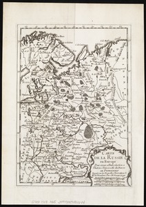
Russia--Maps--Early works to 1800
- Places:
-
Russia
Black Sea
- Extent:
- 1 map on 2 sheets : hand colored ; 83 x 125 cm, sheets 56 x 133 cm
- Terms of Use:
-
No known copyright restrictions.
No known restrictions on use.
- Publisher:
-
London :
Wm. Faden
- Scale:
-
Scale approximately 1:1,630,000
- Language:
-
English
- Notes:
-
State 7.
Originally printed on 4 sheets. Boston Public Library copy joined to make 2 sheets.
Relief shown pictorially.
Prime meridian: Ferro.
Also shows parts of Hungary and Poland.
"This map is compiled by A. Dury and P. Bell."
Below decorative title cartouche: J. Caldwal sculp. -- T: W. Tueur invt.
Conservation of this piece was funded by Alan and Sherry Leventhal in memory of his father, Norman B. Leventhal whose vision to create this Map Center will inspire generations to come.
Maps 24-25 in a composite atlas with the title "Atlas of the world."
- Identifier:
-
06_01_014674
- Call #:
-
G1015 .A85 1783
- Barcode:
-
30000004730328