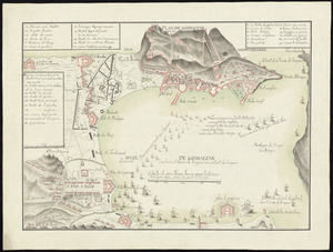
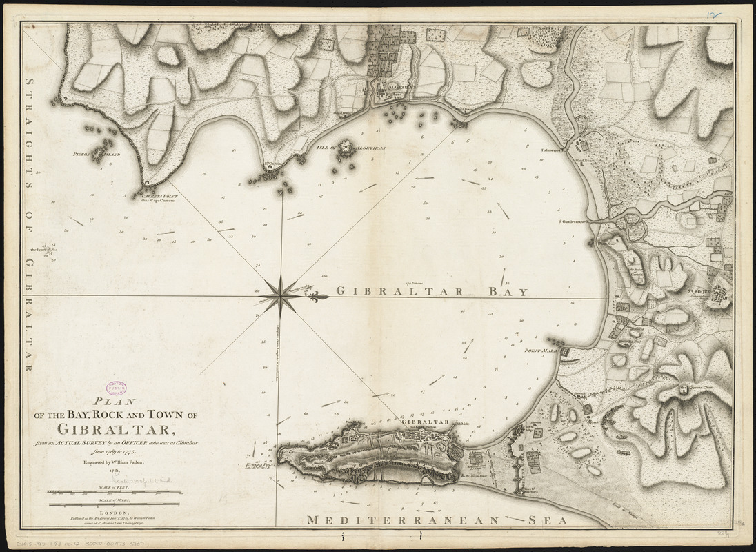
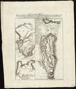
Plan of the bay, rock and town of Gibraltar, from an actual survey by an officer who was at Gibraltar from 1769 to 1775
Item Information
- Title:
- Plan of the bay, rock and town of Gibraltar, from an actual survey by an officer who was at Gibraltar from 1769 to 1775
- Creator:
- Faden, William, 1749-1836
- Engraver:
- Faden, William, 1749-1836
- Publisher:
- Faden, William, 1749-1836
- Name on Item:
-
engraved by William Faden
- Date:
-
1781
- Format:
-
Maps/Atlases
- Location:
-
Boston Public Library
Norman B. Leventhal Map Center - Collection (local):
-
Norman B. Leventhal Map Center Collection
- Subjects:
-
Gibraltar, Bay of (Spain)--Maps--Early works to 1800
Gibraltar--Maps--Early works to 1800
Gibraltar--History--Siege, 1779-1783--Maps--Early works to 1800
- Places:
-
Gibraltar (territory)
Bay of Gibraltar
- Extent:
- 1 map : hand colored ; 52 x 73 cm
- Terms of Use:
-
No known copyright restrictions.
No known restrictions on use.
- Publisher:
-
London :
William Faden
- Scale:
-
Scale approximately 1:24,600
- Language:
-
English
- Notes:
-
Shows ocean currents, buildings, forts, fields, magnetic declination, etc.
Relief shown by hachures. Depths shown by soundings.
Oriented with north to the right.
Includes some notes about the siege.
Conservation of this piece was funded by Alan and Sherry Leventhal in memory of his father, Norman B. Leventhal whose vision to create this Map Center will inspire generations to come.
Map 12 in a composite atlas with the title "Atlas of the world."
- Identifier:
-
06_01_014653
- Call #:
-
G1015 .A85 1783
- Barcode:
-
30000004730207

![[Plan de Gibraltar]](https://bpldcassets.blob.core.windows.net/derivatives/images/commonwealth:z603vt83t/image_thumbnail_300.jpg)