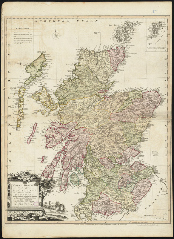
North Britain or Scotland divided into its counties : corrected from the best surveys & astronomical observations
Item Information
- Title:
- North Britain or Scotland divided into its counties : corrected from the best surveys & astronomical observations
- Creator:
- Kitchin, Thomas, 1718-1784
- Cartographer:
- Kitchin, Thomas, 1718-1784
- Publisher:
- Faden, William, 1749-1836
- Name on Item:
-
by Thos. Kitchin, hydrographer to His Majesty.
- Date:
-
1778
- Format:
-
Maps/Atlases
- Location:
-
Boston Public Library
Norman B. Leventhal Map Center - Collection (local):
-
Norman B. Leventhal Map Center Collection
- Subjects:
-
Scotland--Maps--Early works to 1800
- Places:
-
Scotland
- Extent:
- 1 map : hand colored ; 66 x 52 cm
- Terms of Use:
-
No known copyright restrictions.
No known restrictions on use.
- Publisher:
-
London :
Wm. Faden
- Scale:
-
Scale approximately 1:760,000
- Language:
-
English
- Notes:
-
Relief shown pictorially.
Inset: Shetland Isles.
Conservation of this piece was funded by Alan and Sherry Leventhal in memory of his father, Norman B. Leventhal whose vision to create this Map Center will inspire generations to come.
Map 5 in a composite atlas with the title "Atlas of the world."
- Identifier:
-
06_01_014660
- Call #:
-
G1015 .A85 1783
- Barcode:
-
30000004730193


![Exactissima Regni Scotiae tabula tam in septentrionalem et meriodionalem quam in minores earundem provincias, insulasq[ue] ei undique praetensas accurate divisa](https://bpldcassets.blob.core.windows.net/derivatives/images/commonwealth:cj82kz35d/image_thumbnail_300.jpg)
