The world
Item Information
- Title:
- The world
- Description:
-
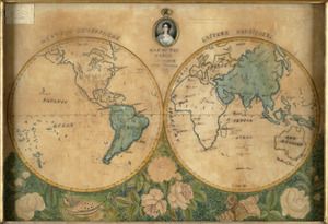
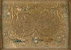
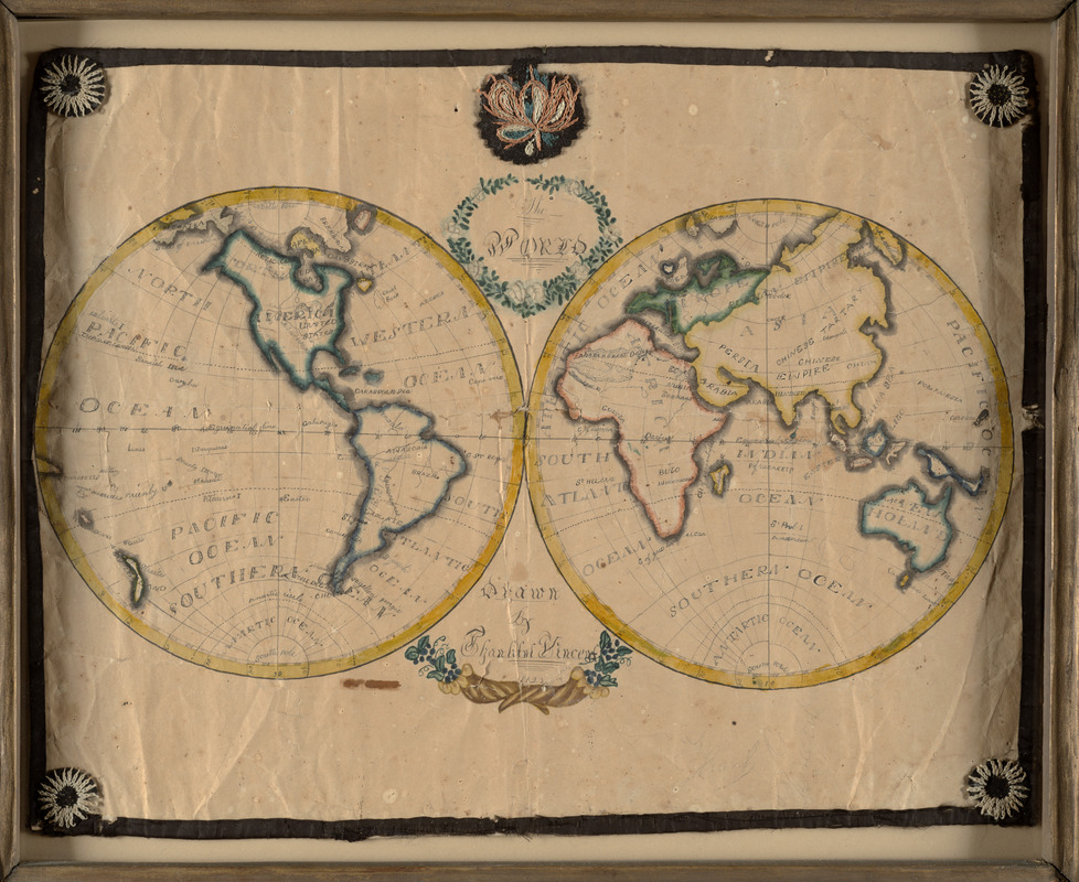
This double-hemisphere world map may be the work of a Quaker girl from Plainfield, Vermont, and is backed on an 1829 newspaper published near Montpelier. A young Thankful Vincent decorated her world map with simple garlands of vines and flowers around the title and her name. She also included embroidery along the margins of the map, at the top center, and in each corner. This schoolgirl map is a charming example of a young student’s combined geography, penmanship and needlework project.
- Cartographer:
- Vincent, Thankful
- Date:
-
1823
- Format:
-
Maps/Atlases
Manuscripts
- Location:
- Private Collection
- Collection (local):
-
Private Collection
- Subjects:
-
World maps
Manuscript maps
- Places:
-
World
- Extent:
- 1 manuscript map : hand colored ; 2 hemispheres each 26 cm in diameter, on sheet 42 x 54 cm
- Terms of Use:
-
No known copyright restrictions.
This work is licensed for use under a Creative Commons Attribution Non-Commercial Share Alike License (CC BY-NC-SA).

- Scale:
-
Scale approximately 1:100,000,000 at equator
- Language:
-
English
- Notes (exhibitions):
-
Exhibited: "Back to School: Geography in the Classroom" organized by the Norman B. Leventhal Map Center at the Boston Public Library, 2014-2015.
- Identifier:
-
06_01_012264