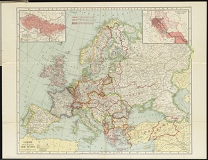
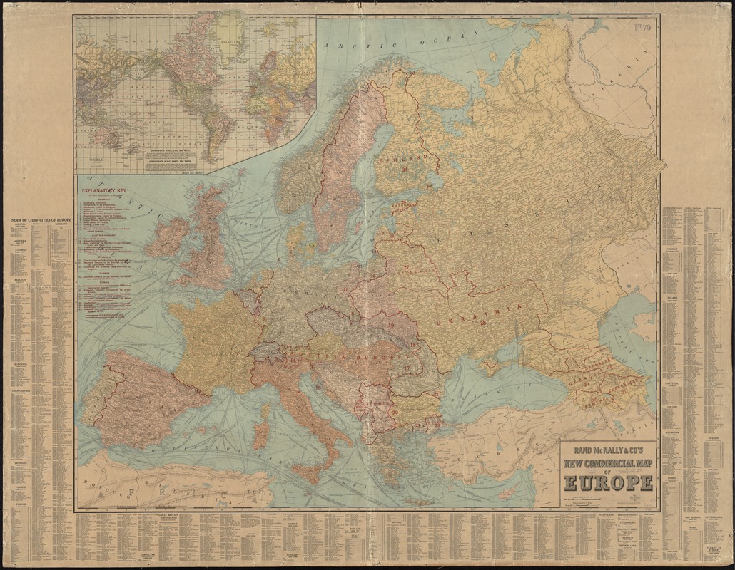
Rand McNally & Co's new commercial map of Europe
Item Information
- Title:
- Rand McNally & Co's new commercial map of Europe
- Title (alt.):
-
New commercial map of Europe
- Creator:
- Rand McNally and Company
- Date:
-
[1922?]
- Format:
-
Maps/Atlases
- Location:
-
Boston Public Library
Norman B. Leventhal Map Center - Collection (local):
-
Norman B. Leventhal Map Center Collection
- Subjects:
-
United States--Maps
Europe--Boundaries--Maps
- Places:
-
Europe
Europe
- Extent:
- 1 map : color ; 98 x 115 cm
- Terms of Use:
-
No known copyright restrictions.
No known restrictions on use.
- Publisher:
-
[Chicago, Illinois] :
Rand McNally & Co.,
- Scale:
-
Scale 1:4,561,920. 72 miles = 1 inch
- Language:
-
English
- Notes:
-
Shows 1914 boundaries and new boundaries after 1918.
Relief shown by hachures.
Inset: World.
Rand McNally & Co.'s new indexed map of the United States on verso.
Boston Public Library copy backed on linen; map of the United States on verso obscured.
Includes index to cities.
"573D."
- Identifier:
-
06_01_012273
- Call #:
-
G5700 1922 .R36
- Barcode:
-
39999065697946