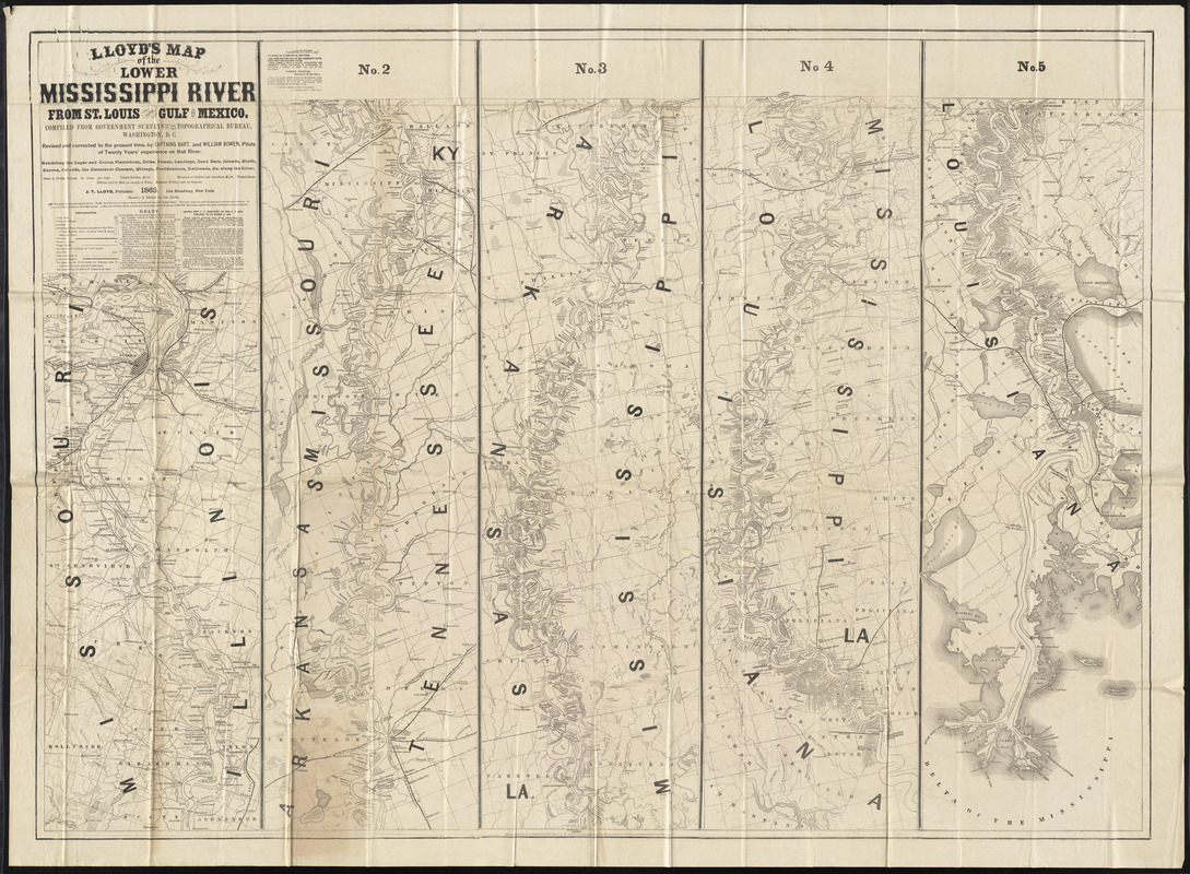
Lloyd's map of the Lower Mississippi River from St. Louis to the Gulf of Mexico : compiled from government surveys in the Topographical Bureau
Item Information
- Title:
- Lloyd's map of the Lower Mississippi River from St. Louis to the Gulf of Mexico : compiled from government surveys in the Topographical Bureau
- Cartographer:
- Lloyd, James T.
- Date:
-
1864
- Format:
-
Maps/Atlases
- Location:
-
Boston Public Library
Norman B. Leventhal Map Center - Collection (local):
-
Norman B. Leventhal Map Center Collection
- Subjects:
-
Mississippi River--Maps
- Places:
-
Mississippi River
- Extent:
- 1 map : color ; 92 x 128 cm
- Terms of Use:
-
No known copyright restrictions.
No known restrictions on use.
- Publisher:
-
New York :
J.T. Lloyd
- Language:
-
English
- Notes:
-
Map in 5 sections, "exhibiting the sugar and cotton plantations, cities, towns, landings, sand bars, islands, bluffs, bayous, cut-offs, the steamboat channel, mileage, fortifications, railroads, &c. along the river."
Map of the United States on verso.
- Identifier:
-
06_01_011909
- Barcode:
-
30000004433548


