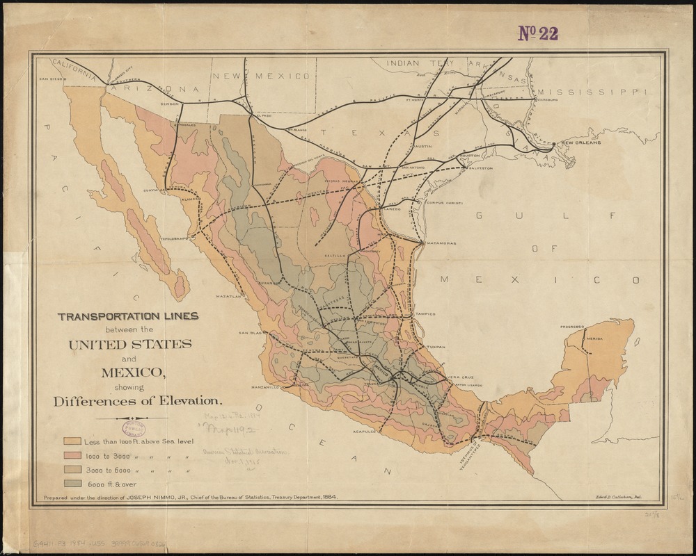
Transportation lines between the United States and Mexico, showing differences of elevation
Item Information
- Title:
- Transportation lines between the United States and Mexico, showing differences of elevation
- Creator:
- United States. Department of the Treasury. . Bureau of Statistics
- Name on Item:
-
prepared under the direction of Joseph Nimmo, Jr., chief of the Bureau of Statistics, Treasury Department, 1884 ; Edwd. D. Callahan, del.
- Date:
-
[1884]
- Format:
-
Maps/Atlases
- Location:
-
Boston Public Library
Norman B. Leventhal Map Center - Collection (local):
-
Norman B. Leventhal Map Center Collection
- Subjects:
-
Railroads--Mexico--Maps
Railroads--Southwestern States--Maps
Railroads--Southern States--Maps
Mexico--Maps
- Places:
-
Southwest (area)
Mexico
Southern United States (area)
- Extent:
- 1 map : color ; 40 x 56 cm
- Terms of Use:
-
No known copyright restrictions.
No known restrictions on use.
- Publisher:
-
[Washington, D.C.] :
[Dept. of the Treasury, Bureau of Statistics?]
- Scale:
-
Scale approximately 1:6,000,000
- Language:
-
English
- Notes:
-
Relief shown by gradient tints.
- Notes (date):
-
This date is inferred.
- Identifier:
-
06_01_011809
- Call #:
-
G4411.P3 1884 .U55
- Barcode:
-
39999065690826