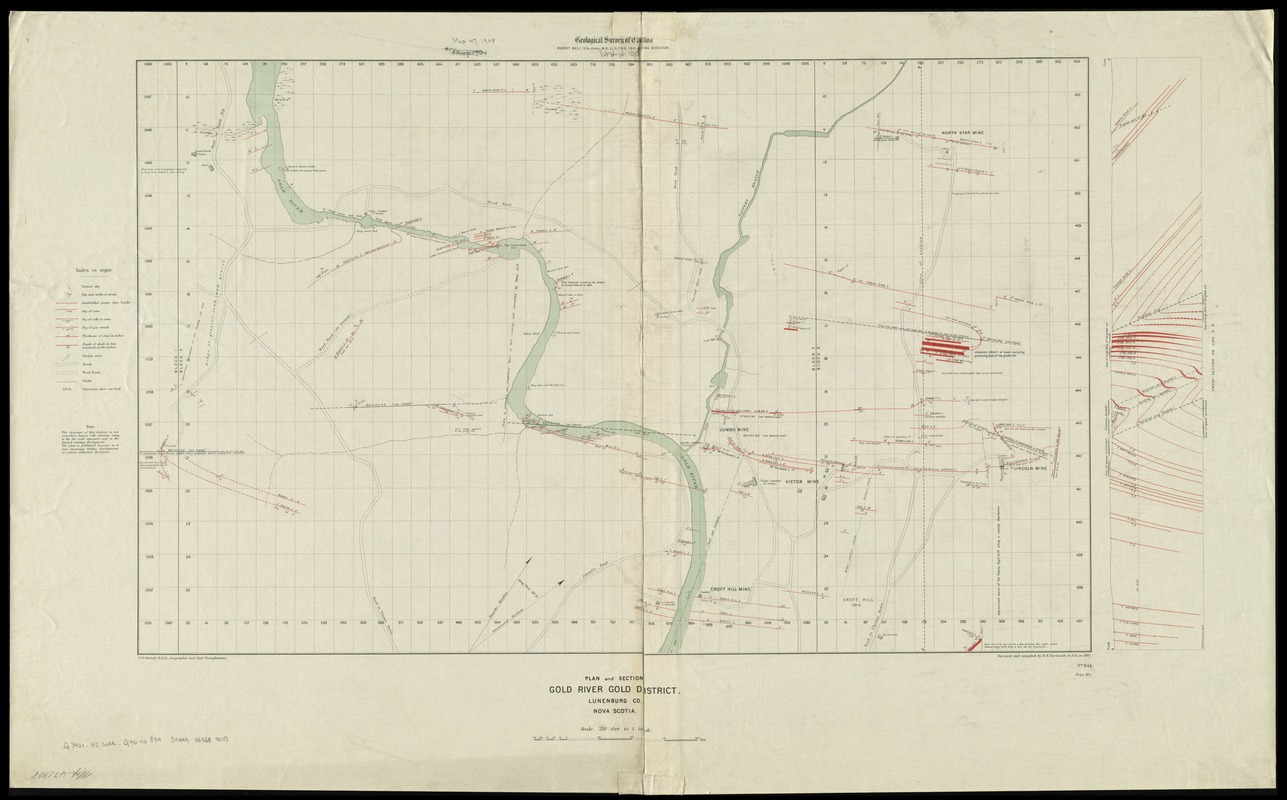
Plan and section, Gold River gold district, Lunenburg Co., Nova Scotia
Item Information
- Title:
- Plan and section, Gold River gold district, Lunenburg Co., Nova Scotia
- Title (alt.):
-
Gold River gold district
- Creator:
- Geological Survey of Canada
- Name on Item:
-
C.O. Senecal, B.A. Sc., geographer and chief draughtsman ; surveyed and compiled by E.R. Faribault, B.A. Sc., in 1902.
- Date:
-
1904
- Format:
-
Maps/Atlases
- Location:
-
Boston Public Library
Norman B. Leventhal Map Center - Collection (local):
-
Norman B. Leventhal Map Center Collection
- Subjects:
-
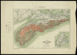
Geology--Nova Scotia--Lunenburg (County)--Maps
Mines and mineral resources--Nova Scotia--Lunenburg (County)--Maps
Geology--Nova Scotia--Gold River--Maps
Mines and mineral resources--Nova Scotia--Gold River--Maps
Gold mines and mining--Nova Scotia--Maps
Gold River (N.S.)--Maps
Chester (N.S.)--Maps
Lunenburg (N.S. : County)--Maps
- Places:
-
Lunenburg County
Gold River
Chester
- Extent:
- 1 map : col. ; 46 x 74 cm
- Terms of Use:
-
No known copyright restrictions.
No known restrictions on use.
- Publisher:
-
[Ottawa] :
Geological Survey of Canada
- Scale:
-
Scale 1:3,000, 250 feet to 1 inch
- Language:
-
English
- Notes:
-
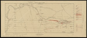
Relief shown by spot heights.
Includes cross-section diagram, legend and note.
- Identifier:
-
06_01_011707
- Call #:
-
G3421.H2 svar .G46 no. 844
- Barcode:
-
30000004221541