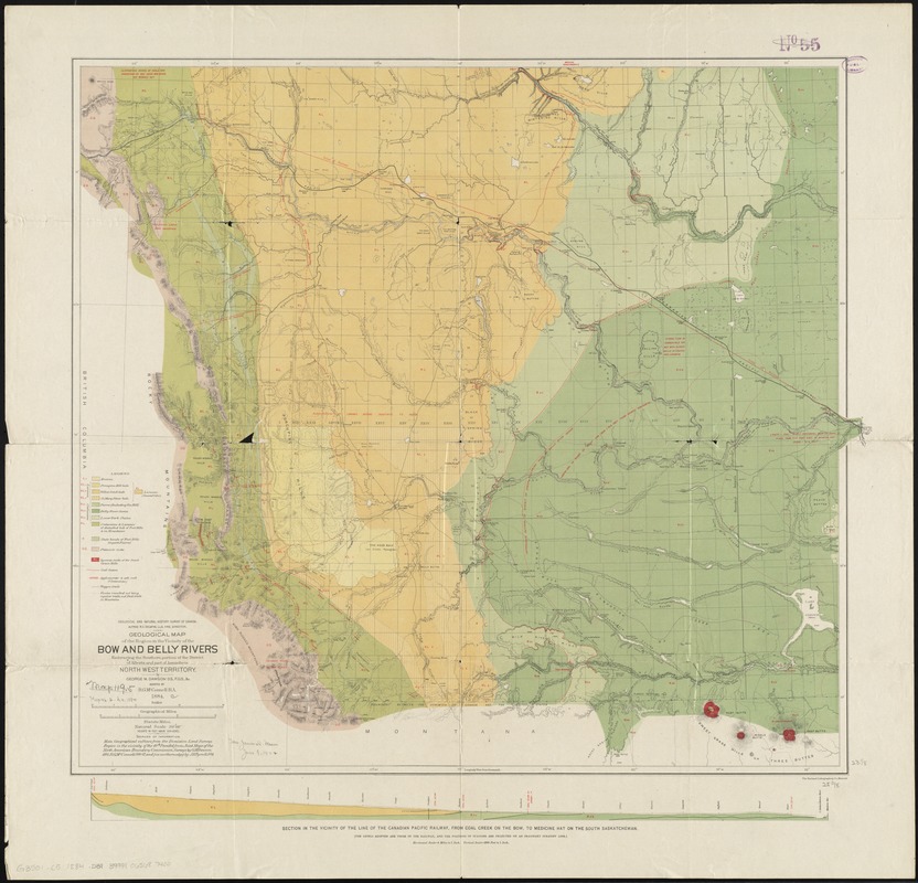
Geological map of the region in the vicinity of the Bow and Belly Rivers : embracing the southern portion of the District of Alberta and part of Assiniboia, Northwest Territory
Item Information
- Title:
- Geological map of the region in the vicinity of the Bow and Belly Rivers : embracing the southern portion of the District of Alberta and part of Assiniboia, Northwest Territory
- Creator:
- Dawson, George Mercer, 1849-1901
- Name on Item:
-
by George M. Dawson, assisted by R.G.McConnell ; Geological and Natural History Survey of Canada.
- Date:
-
1884
- Format:
-
Maps/Atlases
- Location:
-
Boston Public Library
Norman B. Leventhal Map Center - Collection (local):
-
Norman B. Leventhal Map Center Collection
- Subjects:
-
Geology--Alberta--Maps
Bow River Valley (Alta.)--Maps
Belly River Valley (Mont. and Alta.)--Maps
- Places:
-
CanadaProvince of Alberta (province)Bow (river)
Belly River (river)
- Extent:
- 1 map : col. ; 59 x 67 cm.
- Terms of Use:
-
No known copyright restrictions.
No known restrictions on use.
- Publisher:
-
[Ottawa] :
The Survey
- Scale:
-
Scale 1:506,880
- Language:
-
English
- Notes:
-
Relief shown by hachures and spot heights.
Includes cross section from Coal Creek to Medicine Hat.
- Identifier:
-
06_01_011667
- Call #:
-
G3501.C5 1884 .D39
- Barcode:
-
39999065687400


