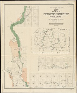
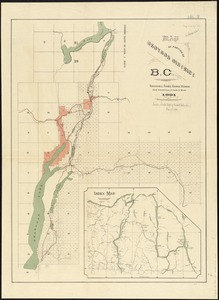
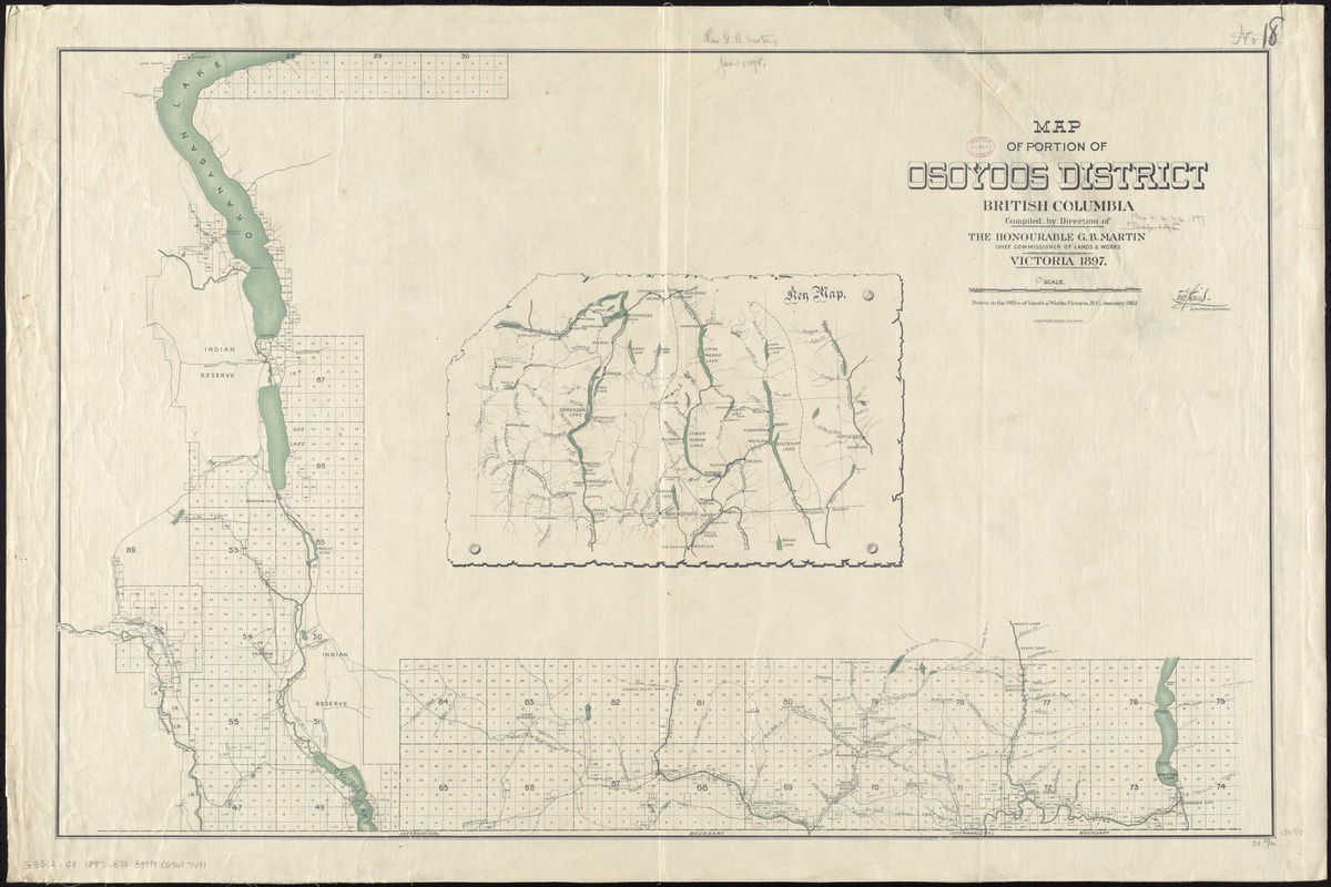
Map of portion of Osoyoos District, British Columbia
Item Information
- Title:
- Map of portion of Osoyoos District, British Columbia
- Creator:
- British Columbia. Department of Lands and Works
- Name on Item:
-
drawn in the Office of Lands and Works ; compiled by direction of the Honourable G.B. Martin, Chief Commissioner of Lands and Works.
- Date:
-
1897
- Format:
-
Maps/Atlases
- Location:
-
Boston Public Library
Norman B. Leventhal Map Center - Collection (local):
-
Norman B. Leventhal Map Center Collection
- Subjects:
-
British Columbia--Maps
Osoyoos Lake Region (B.C. and Wash.)--Maps
Okanagan Valley (B.C. : Region)--Maps
Okanagan-Similkameen (B.C.)--Maps
Kootenay Boundary (B.C.)--Maps
- Places:
-
CanadaProvince of British Columbia (province)
Osoyoos Lake
Regional District of Kootenay-Boundary
Okanagan
Regional District of Okanagan-Similkameen
- Extent:
- 1 map : color ; 56 x 87 cm
- Terms of Use:
-
No known copyright restrictions.
No known restrictions on use.
- Publisher:
-
Victoria, B.C :
Lands and Works
- Scale:
-
Scale [ca. 1:158,000]
- Language:
-
English
- Notes:
-
Dated "January 1897."
Inset: Key map.
- Identifier:
-
06_01_011650
- Call #:
-
G3512.O8 1897 .B75
- Barcode:
-
39999065687491