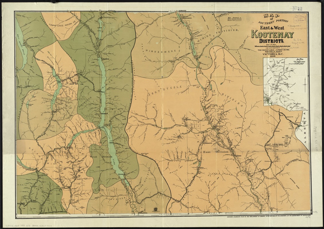
Map of southern portion East & West Kootenay Districts
Item Information
- Title:
- Map of southern portion East & West Kootenay Districts
- Title (alt.):
-
Map of southern portion East and West Kootenay Districts
- Creator:
- British Columbia. Department of Mines
- Name on Item:
-
compiled by direction of the honorable J. Fred Hume, Minister of Mines.
- Date:
-
1898
- Format:
-
Maps/Atlases
- Location:
-
Boston Public Library
Norman B. Leventhal Map Center - Collection (local):
-
Norman B. Leventhal Map Center Collection
- Subjects:
-
Mines and mineral resources--British Columbia--Kootenay Region--Maps
Kootenay Region (B.C.)--Administrative and political divisions--Maps
Kootenay Region (B.C.)--Maps
- Places:
-
Kootenay
- Extent:
- 1 map : col. ; 65 x 93 cm
- Terms of Use:
-
No known copyright restrictions.
No known restrictions on use.
- Publisher:
-
Victoria, B.C :
Minister of Mines
- Scale:
-
Scale [ca. 1:253,440]
- Language:
-
English
- Notes:
-
Inset: Key map of Wild Horse Creek and tributary streams shewing groups of mining claims.
- Identifier:
-
06_01_011645
- Call #:
-
G3512.K62 1898 .B75
- Barcode:
-
39999065687715