British Columbia : Kamloops sheet, geologically coloured
Item Information
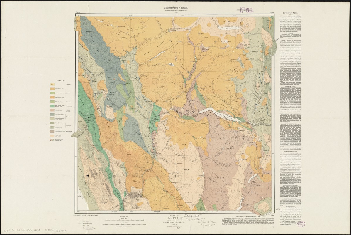
- Title:
- British Columbia : Kamloops sheet, geologically coloured
- Title (alt.):
-
Kamloops sheet : geologically coloured
- Creator:
- McEvoy, James.
- Name on Item:
-
compiled and drawn by James McEvoy B.A. sc. ; by George M. Dawson, C.M.G., L.L.D., F.R.S.
- Date:
-
1895
- Format:
-
Maps/Atlases
- Location:
-
Boston Public Library
Norman B. Leventhal Map Center - Collection (local):
-
Norman B. Leventhal Map Center Collection
- Subjects:
-
Geology--British Columbia--Maps
Geology--British Columbia--Thompson-Nicola--Maps
Thompson-Nicola (B.C.)--Maps
British Columbia--Maps
- Places:
-
CanadaProvince of British Columbia (province)
Thompson-Nicola Regional District
- Extent:
- 1 map : col. ; 53 x 54 cm.
- Terms of Use:
-
No known copyright restrictions.
No known restrictions on use.
- Publisher:
-
[Ottawa, Ont.] :
Geological Survey of Canada
- Scale:
-
Scale 1:253,440
- Language:
-
English
- Notes:
-
Relief shown by contours.
At head of map "Geological Survey of Canada, George M. Dawson, C.M.G., L.L.D., F.R.S. & c. Director."
"Sheet No. 12."
"556."
Includes "Explanatory Notes."
- Identifier:
-
06_01_011642
- Call #:
-
G3513.T55C5 1895 .M33
- Barcode:
-
39999065687681


