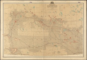
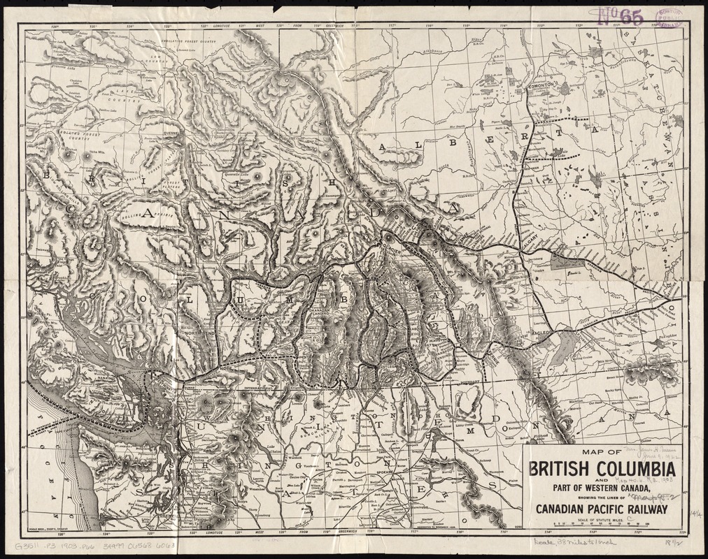
Map of British Columbia and part of western Canada, showing the lines and lands of the Canadian Pacific Railway
Item Information
- Title:
- Map of British Columbia and part of western Canada, showing the lines and lands of the Canadian Pacific Railway
- Creator:
- Poole Brothers
- Name on Item:
-
Poole Bros., engr's.
- Date:
-
[1903]
- Format:
-
Maps/Atlases
- Location:
-
Boston Public Library
Norman B. Leventhal Map Center - Collection (local):
-
Norman B. Leventhal Map Center Collection
- Subjects:
-
Canadian Pacific Railway Company--Maps
Railroads--British Columbia--Maps
Railroads--Alberta--Maps
British Columbia--Maps
Alberta--Maps
Canada, Western--Maps
- Places:
-
CanadaProvince of British Columbia (province)
- Extent:
- 1 map ; 36 x 47 cm.
- Terms of Use:
-
No known copyright restrictions.
No known restrictions on use.
- Publisher:
-
Chicago :
Poole Bros.
- Scale:
-
Scale [ca. 1:2,400,000]
- Language:
-
English
- Notes:
-
Relief shown by hachures.
"Corrected to November 1903."
- Notes (date):
-
This date is inferred.
- Identifier:
-
06_01_011593
- Call #:
-
G3511.P3 1903 .P66
- Barcode:
-
39999065686063