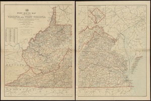
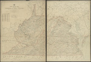
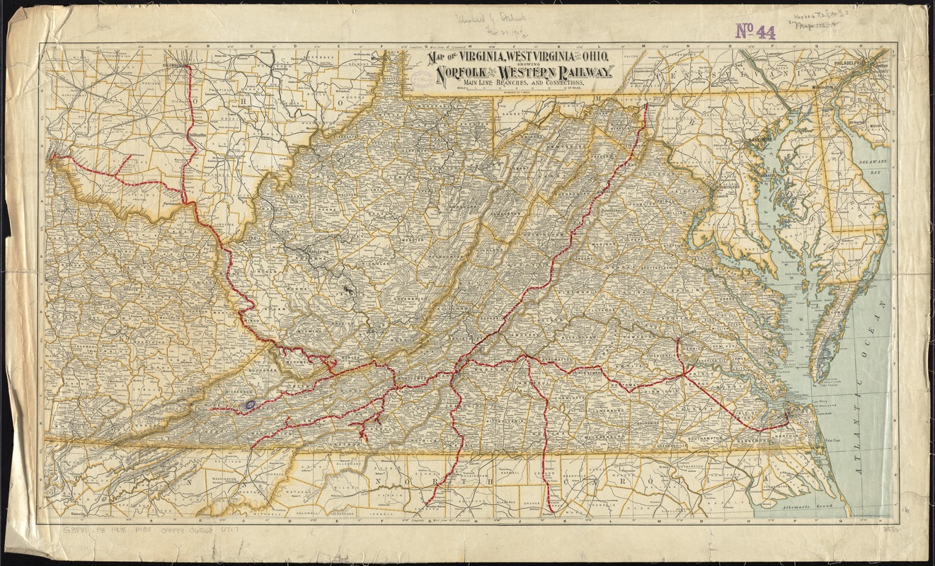
Map of Virginia, West Virginia and Ohio : showing Norfolk and Western Railway : main line branches and connections
Item Information
- Title:
- Map of Virginia, West Virginia and Ohio : showing Norfolk and Western Railway : main line branches and connections
- Creator:
- Matthews-Northrup Company
- Date:
-
[1902–1908]
- Format:
-
Maps/Atlases
- Location:
-
Boston Public Library
Norman B. Leventhal Map Center - Collection (local):
-
Norman B. Leventhal Map Center Collection
- Subjects:
-
Norfolk and Western Railway Company--Maps
Railroads--Virginia--Maps
Railroads--West Virginia--Maps
Railroads--Ohio--Maps
Virginia--Maps
West Virginia--Maps
Ohio--Maps
- Places:
-
Ohio
Virginia
West Virginia
- Extent:
- 1 map : col. ; 41 x 74 cm.
- Terms of Use:
-
No known copyright restrictions.
No known restrictions on use.
- Publisher:
-
Buffalo, N.Y :
Matthews-Northrup Co.
- Scale:
-
Scale [1:1,140,480]. 18 miles to 1 inch
- Language:
-
English
- Notes:
-
Relief shown by hachures.
Date estimated from established counties.
- Notes (date):
-
This date is inferred.
- Identifier:
-
06_01_011520
- Call #:
-
G3881.P3 1908 .M38
- Barcode:
-
39999065686717