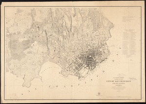
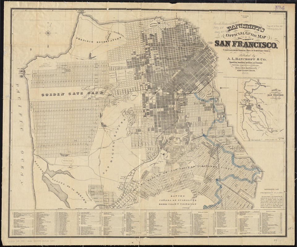
Bancroft's official guide map of city and county of San Francisco
Item Information
- Title:
- Bancroft's official guide map of city and county of San Francisco
- Title (alt.):
-
Official guide map of city and county of San Francisco
- Creator:
- A.L. Bancroft & Company
- Name on Item:
-
compiled from official maps in Surveyor's office.
- Date:
-
1881
- Format:
-
Maps/Atlases
- Location:
-
Boston Public Library
Norman B. Leventhal Map Center - Collection (local):
-
Norman B. Leventhal Map Center Collection
- Subjects:
-
San Francisco (Calif.)--Maps
- Places:
-
San Francisco (county)
- Extent:
- 1 map : col. ; 62 x 75 cm. folded in cover 16 x 11 cm.
- Terms of Use:
-
No known copyright restrictions.
No known restrictions on use.
- Publisher:
-
San Francisco :
A.L. Bancroft
- Scale:
-
Scale [ca. 1:22,000]
- Language:
-
English
- Notes:
-
Inset: Skeleton map showing the relative position of San Francisco to the surrounding country.
Includes index of cemeteries, churches, hospitals, hotels, parks, public buildings, railroad depots, schools and colleges, theater halls, wharves and ferries.
- Identifier:
-
06_01_011420
- Call #:
-
G4364.S5 1881 .A42
- Barcode:
-
39999065685891