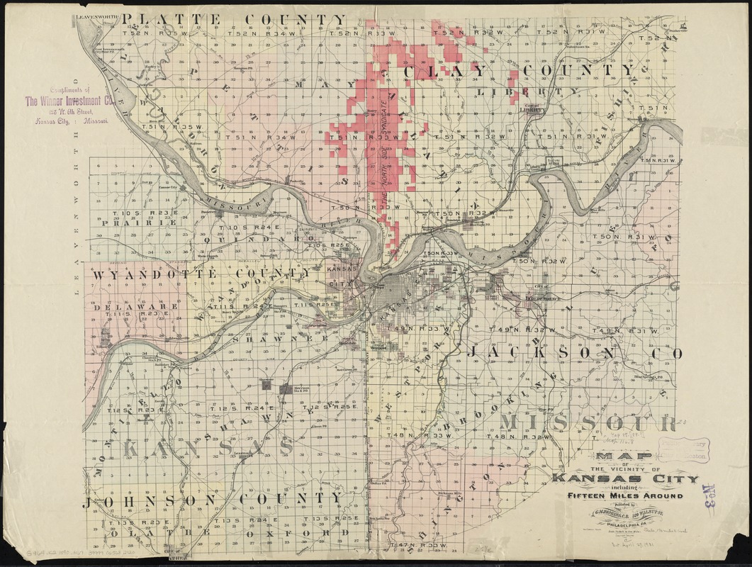
Map of the vicinity of Kansas City : including fifteen miles around
Item Information
- Title:
- Map of the vicinity of Kansas City : including fifteen miles around
- Creator:
- Hopkins, Griffith Morgan, Jr
- Name on Item:
-
MacCormac, engr.
- Date:
-
[1890?–1899?]
- Format:
-
Maps/Atlases
- Location:
-
Boston Public Library
Norman B. Leventhal Map Center - Collection (local):
-
Norman B. Leventhal Map Center Collection
- Subjects:
-
Kansas City (Kan.)--Maps
Kansas City (Mo.)--Maps
- Places:
-
Wyandotte (county)Kansas City
- Extent:
- 1 map : hand col. ; sheet 61 x 82 cm.
- Terms of Use:
-
No known copyright restrictions.
No known restrictions on use.
- Publisher:
-
Philadelphia, Pa :
G.M. Hopkins
- Scale:
-
Scale [1:84,480]. 3/4 in. = 1 mile
- Language:
-
English
- Notes:
-
Shows railroads and townships and range grid.
- Identifier:
-
06_01_011236
- Call #:
-
G4164.K2 1890 .H67
- Barcode:
-
39999065682120