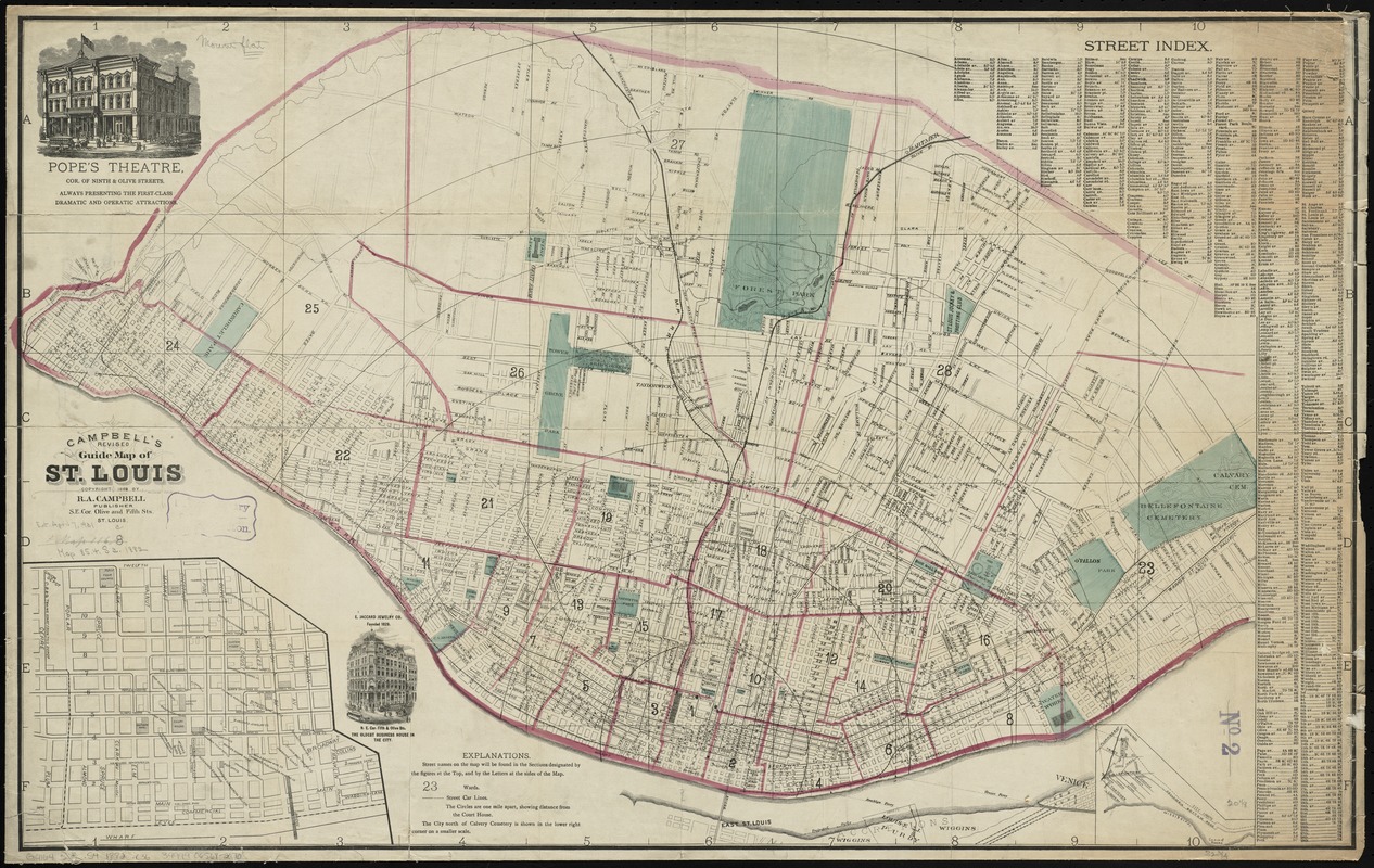
Campbell's revised guide map of St. Louis
Item Information
- Title:
- Campbell's revised guide map of St. Louis
- Creator:
- Campbell, R. A. (Robert Allen), 1836 or 1837-
- Lithographer:
- Juehne, Charles
- Name on Item:
-
Chas. Juehne lith.
- Date:
-
1882
- Format:
-
Maps/Atlases
- Location:
-
Boston Public Library
Norman B. Leventhal Map Center - Collection (local):
-
Norman B. Leventhal Map Center Collection
- Subjects:
-
Saint Louis (Mo.)--Maps
- Places:
-
Saint Louis
- Extent:
- 1 map : hand color ; 52 x 84 cm
- Terms of Use:
-
No known copyright restrictions.
No known restrictions on use.
- Publisher:
-
St. Louis :
R.A. Campbell
- Scale:
-
Scale [ca. 1:25,000]
- Language:
-
English
- Notes:
-
Oriented with north to the right.
Shows concentric circles drawn in one mile intervals from the Court House.
Includes street index, advertisements and inset maps of downtown and the city north of Calvary Cemetery.
- Identifier:
-
06_01_011250
- Call #:
-
G4164.S4 1882 .C36
- Barcode:
-
39999065682070