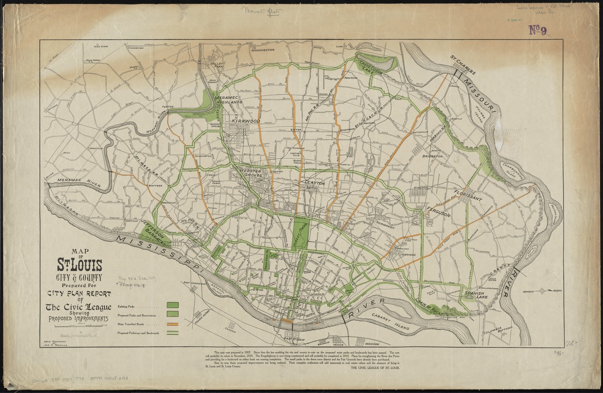
Map of St. Louis city & county : prepared for City Plan Report of The Civic League showing proposed improvements
Item Information
- Title:
- Map of St. Louis city & county : prepared for City Plan Report of The Civic League showing proposed improvements
- Title (alt.):
-
Map of Saint Louis city and county
- Creator:
- Travilla, James C.
- Name on Item:
-
map prepared by Jas. C. Travilla.
- Date:
-
1907
- Format:
-
Maps/Atlases
- Location:
-
Boston Public Library
Norman B. Leventhal Map Center - Collection (local):
-
Norman B. Leventhal Map Center Collection
- Subjects:
-
Parks--Missouri--Saint Louis--Maps
Parkways--Missouri--Saint Louis--Maps
Saint Louis (Mo.)--Maps
Saint Louis County (Mo.)--Maps
- Places:
-
Saint Louis (county)
- Extent:
- 1 map : col. ; 44 x 75 cm.
- Terms of Use:
-
No known copyright restrictions.
No known restrictions on use.
- Publisher:
-
St. Louis, Mo :
Civic League of St. Louis
- Scale:
-
Scale [ca. 1:70,500]
- Language:
-
English
- Notes:
-
Shows existing and proposed parks and reservations; also, main travelled roads and proposed parkways and boulevards.
Oriented with north to the right.
In lower margin: This map was prepared in 1907 ... The Civic League of St. Louis.
- Identifier:
-
06_01_011238
- Call #:
-
G4163.S35 1907 .T73
- Barcode:
-
39999065682153