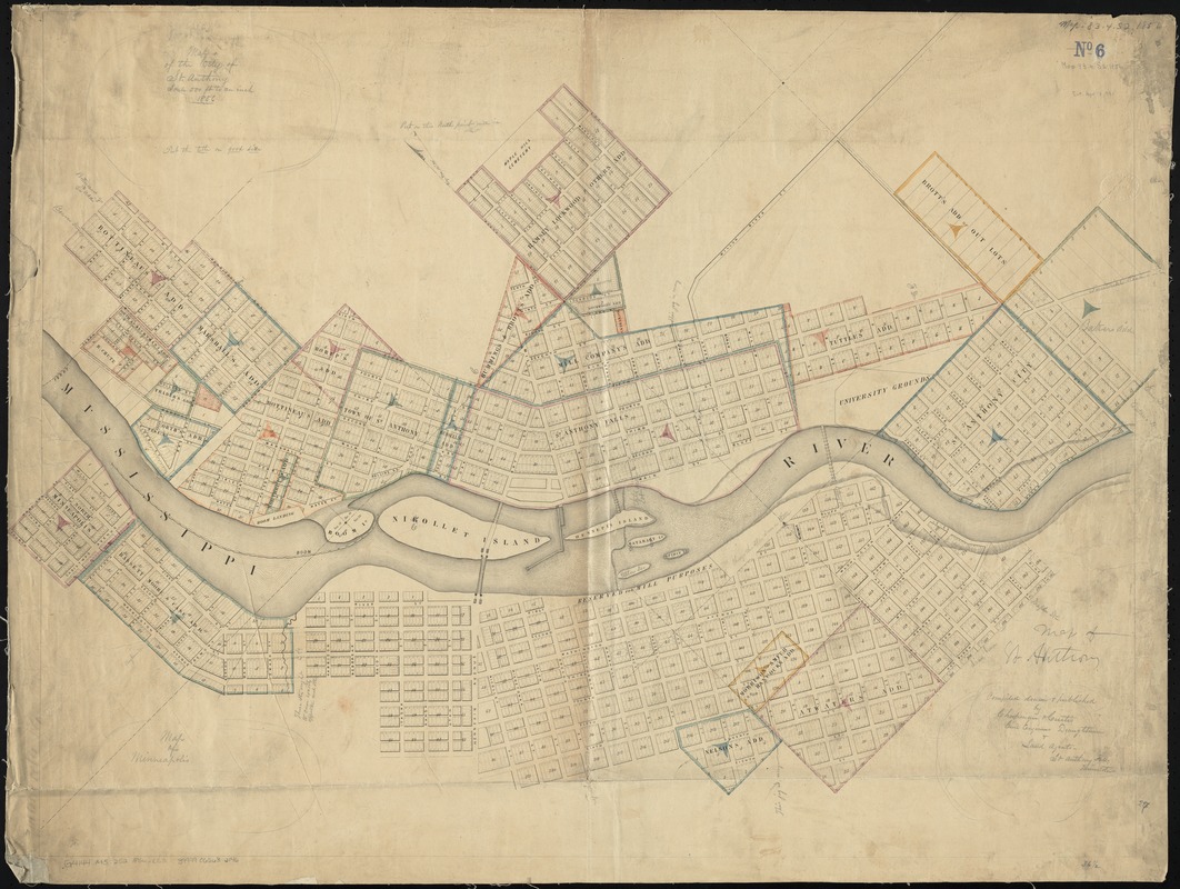
Map of the city of St. Anthony ; map of Minneapolis ; map of St. Anthony
Item Information
- Title:
- Map of the city of St. Anthony ; map of Minneapolis ; map of St. Anthony
- Creator:
- Chapman & Curtis.
- Name on Item:
-
compiled, drawn & published by Chapman & Curtis, Civil Engineers, Draughtmen & Land Agents.
- Date:
-
1856
- Format:
-
Maps/Atlases
- Location:
-
Boston Public Library
Norman B. Leventhal Map Center - Collection (local):
-
Norman B. Leventhal Map Center Collection
- Subjects:
-
Saint Anthony (Hennepin County, Minn. : 1855-1872)
Minneapolis (Minn.)--Maps
- Places:
-
Hennepin (county)Minneapolis
Hennepin (county)Saint Anthony
- Extent:
- 1 map : col. ; 72 x 94 cm.
- Terms of Use:
-
No known copyright restrictions.
No known restrictions on use.
- Publisher:
-
St. Anthony Falls, Minnesota :
Chapman & Curtis
- Scale:
-
Scale [1:6,000]. 500 ft. to an inch
- Language:
-
English
- Notes:
-
Preliminary printing with manuscript corrections, title, imprint and scale.
Cadastral map.
Relief shown by hachures.
Oriented with north to the upper left.
- Identifier:
-
06_01_011237
- Call #:
-
G4144.M5:2S2 1856 .C53
- Barcode:
-
39999065682146