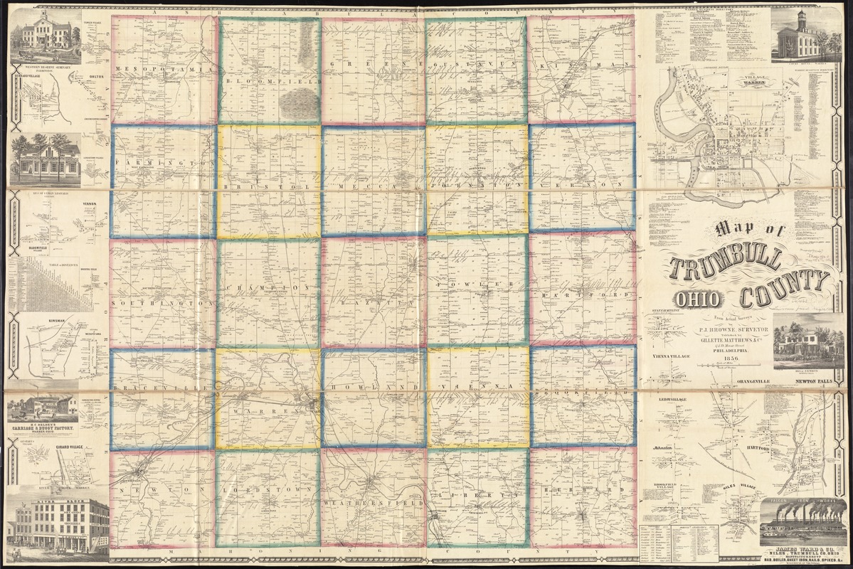
Map of Trumbull County, Ohio
Item Information
- Title:
- Map of Trumbull County, Ohio
- Creator:
- Browne, P. J.
- Name on Item:
-
from actual surveys by P.J. Browne, surveyor.
- Date:
-
1856
- Format:
-
Maps/Atlases
- Location:
-
Boston Public Library
Norman B. Leventhal Map Center - Collection (local):
-
Norman B. Leventhal Map Center Collection
- Subjects:
-
Landowners--Ohio--Trumbull County--Maps
Buildings--Ohio--Trumbull County--Pictorial works
Real property--Ohio--Trumbull County--Maps
Cities and towns--Ohio--Trumbull County--Maps
Trumbull County (Ohio)--Maps
- Places:
-
Trumbull (county)
- Extent:
- 1 map on 2 sheets : mounted on linen, hand color ; 98 x 146 cm
- Terms of Use:
-
No known copyright restrictions.
No known restrictions on use.
- Publisher:
-
Philadelphia :
Gillette, Matthews & Co.,
- Scale:
-
Scale approximately 1:44,000
- Language:
-
English
- Notes:
-
Includes distance table, business directory, population and agricultural statistical table, 23 insets and 7 views of public, residential, and commercial properties.
Insets: Fowler Village -- Hubbard Village -- Ohlton -- Greenecentre Cornrs [sic] -- Lordstown Village -- Bloomfield Village -- Vernon -- Britol Ville -- Kinsman -- Village of Mesopotamia -- Farmington Centre -- Gustavus Village -- Girard Village -- Village of Warren -- West Farmington -- Vienna Village -- Leroy Village -- Orangeville -- Newton Falls -- Johnston -- Brookville Village -- Hartford -- Niles Village.
BPL copy assembled, sectioned to 4 sheets and mounted on cloth.
- Identifier:
-
06_01_011283
- Call #:
-
G4083.T7 1856 .B76
- Barcode:
-
39999065683482
- LCCN:
-
2012592395


