Map of Pike County, Illinois
Item Information
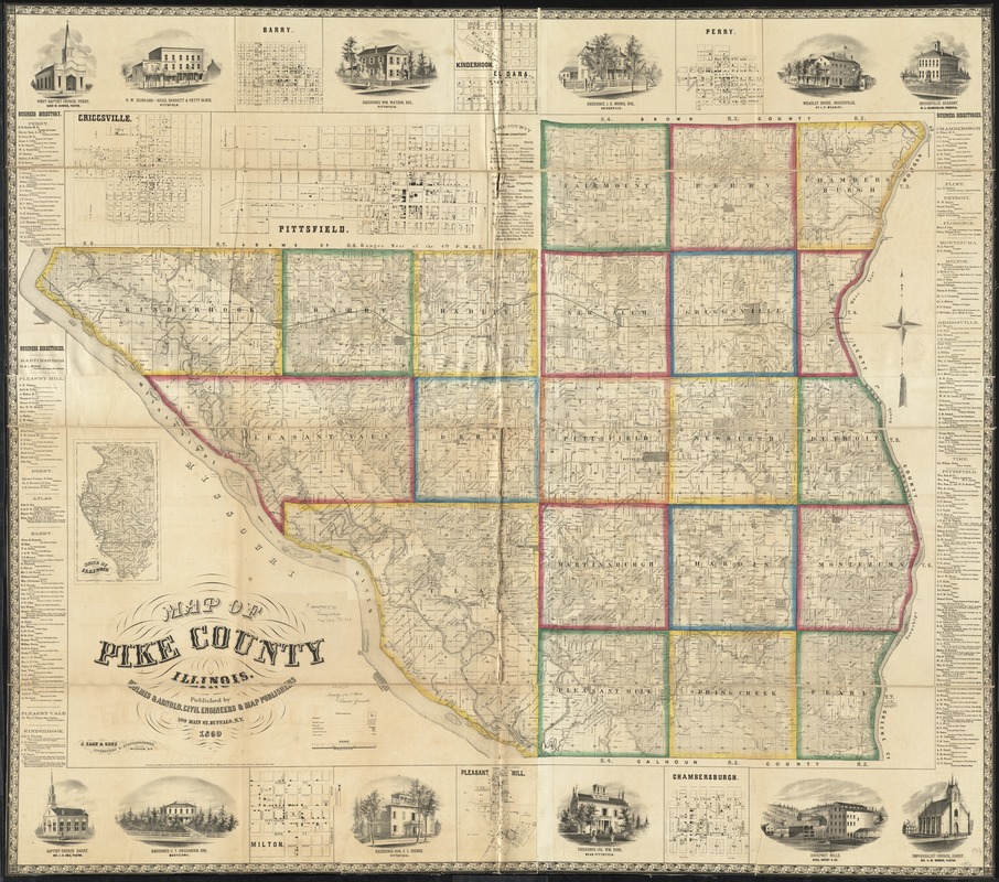
- Title:
- Map of Pike County, Illinois
- Creator:
- Holmes & Arnold
- Name on Item:
-
Holmes & Arnold, Civil Engineers & Map Publishers ; J. Sage & Sons, engravers & lithographers.
- Date:
-
1860
- Format:
-
Maps/Atlases
- Location:
-
Boston Public Library
Norman B. Leventhal Map Center - Collection (local):
-
Norman B. Leventhal Map Center Collection
- Subjects:
-
Landowners--Illinois--Pike County--Maps
Real property--Illinois--Pike County--Maps
Pike County (Ill.)--Maps
- Places:
-
Pike (county)
- Extent:
- 1 map : color ; 133 x 131 cm
- Terms of Use:
-
No known copyright restrictions.
No known restrictions on use.
- Publisher:
-
Buffalo, N.Y. :
Holmes & Arnold, Civil Engineers & Map Publishers,
- Scale:
-
Scale approximately 1:47,520. 60 chains to an inch
- Language:
-
English
- Notes:
-
Entered according to Act of Congress AD1860 by Holmes & Arnold in the Clerks Office of the District Court of the Northern District of New York.
Includes business directories, views of public, residential, and commercial properties.
Insets: Criggsville -- Barry -- Kinderhook -- El Dara -- Perry -- Chambersburgh -- Pleasant Hill -- Milton -- State of Illinois.
- Identifier:
-
06_01_011111
- Call #:
-
G4103.P6 1860 .H65
- Barcode:
-
39999065681239
- LCCN:
-
2013593092


