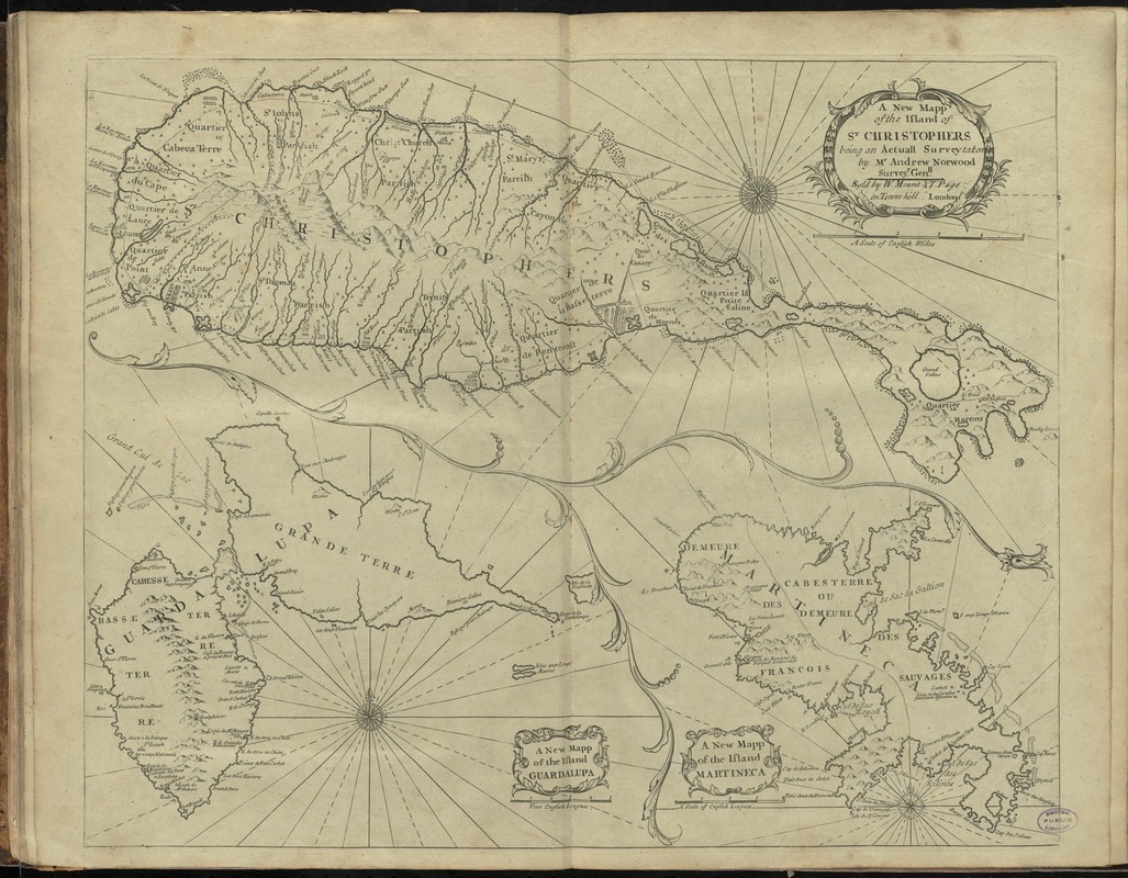
A new mapp of the island of St. Christophers
This map is also available in American Revolutionary Geographies Online (ARGO), a collections portal especially built for material relating to the American Revolutionary War Era. Visit ARGO to learn more about this item and explore the historical geography of North America in the late eighteenth century.
Item Information
- Title:
- A new mapp of the island of St. Christophers
- Title (alt.):
-
New map of the island of St. Christophers
New mapp of the island Guardalupa
New mapp of the island Martineca
- Creator:
- Norwood, Andrew
- Surveyor:
- Norwood, Andrew
- Publisher:
- W. & J. Mount & T. Page
- Name on Item:
-
being an actuall survey taken by Mr. Andrew Norwood, surveyr. genll.
- Date:
-
[1761]
- Format:
-
Maps/Atlases
- Location:
-
Boston Public Library
Norman B. Leventhal Map Center - Collection (local):
-
Norman B. Leventhal Map Center Collection
- Subjects:
-
Landowners--Saint Kitts and Nevis--Saint Kitts--Maps
Saint Kitts--Maps
Guadeloupe--Maps
Martinique--Maps
- Places:
-
Guadeloupe (territory)
Saint Kitts (island)
Martinique (territory)
- Extent:
- 3 maps on 1 sheet ; 44 x 54 cm.
- Terms of Use:
-
No known copyright restrictions.
No known restrictions on use.
- Publisher:
-
London :
Sold by W. Mount & T. Page, on Tower-Hill,
- Scale:
-
Scale [ca. 1:70,000]
Scale [ca. 1:324,000]
Scale [ca. 1:432,000]
- Language:
-
English
- Table of Contents:
-
A new mapp of the island of St. Christophers
A new mapp of the island Guardalupa
A new mapp of the island Martineca.
- Notes:
-
Shows parishes, churches, fortifications, and landowners.
Relief shown pictorially.
In the English pilot, the fourth book, after p. 26. London : Printed for W. and J. Mount, T. Page and son, on Tower-Hill, 1761.
- Notes (date):
-
This date is inferred.
- Identifier:
-
06_01_011102
- Call #:
-
G1106.P5 E54 1761
- Barcode:
-
30000004177671