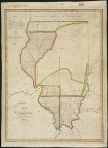
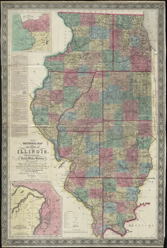
New sectional map of the state of Illinois : compiled from the United States surveys, also exhibiting the internal improvements, distances between towns, villages & post offices, the outlines of prairies, woodlands, marshes & the lands donated to the state by the genl govt. for the purpose of internal improvements
Item Information
- Title:
- New sectional map of the state of Illinois : compiled from the United States surveys, also exhibiting the internal improvements, distances between towns, villages & post offices, the outlines of prairies, woodlands, marshes & the lands donated to the state by the genl govt. for the purpose of internal improvements
- Creator:
- Peck, John Mason, 1789-1858
- Name on Item:
-
by J.M. Peck, John Messinger, and A.K. Mathewson.
- Date:
-
1852
- Format:
-
Maps/Atlases
- Location:
-
Boston Public Library
Norman B. Leventhal Map Center - Collection (local):
-
Norman B. Leventhal Map Center Collection
- Subjects:
-
Illinois--Maps
- Places:
-
Illinois
- Extent:
- 1 map : col. ; 98 x 63 cm.
- Terms of Use:
-
No known copyright restrictions.
No known restrictions on use.
- Publisher:
-
New York :
J.H. Colton & Co.
- Scale:
-
Scale [1:633,600]. 10 miles to an inch
- Language:
-
English
- Notes:
-
Prime meridian: Washington.
Includes notes on public lands, land districts and Illinois & Michigan Canal.
Insets: Vicinity of Galena, the lead region, and part of Wisconsin and Iowa -- Vicinity of Alton & St. Louis.
Includes vertical profile of the Illinois & Michigan Canal.
"Entered according to Act of Congress in the year 1836, by J.H. Colton & Co. ..."
- Identifier:
-
06_01_011089
- Call #:
-
G4100 1852 .P43
- Barcode:
-
39999065681411

![[Illinois]](https://bpldcassets.blob.core.windows.net/derivatives/images/commonwealth:4m90f716w/image_thumbnail_300.jpg)