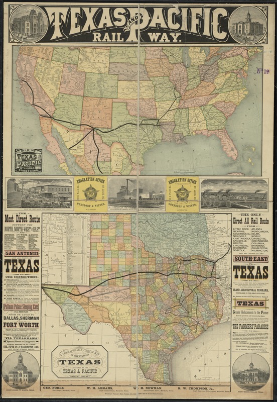
Texas and Pacific Rail Way
Item Information
- Title:
- Texas and Pacific Rail Way
- Title (alt.):
-
Texas and Pacific Railway
- Description:
-
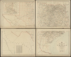
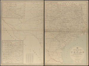
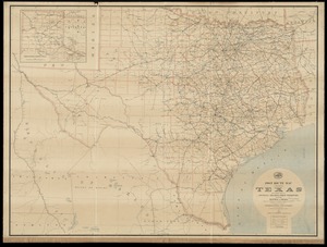
America Transformed: After the Civil War, there was strong interest in constructing a new transcontinental route across the southwestern United States. In 1871, Congress chartered the Texas and Pacific Railway to build a railroad from eastern Texas to San Diego. This map highlights the proposed route to promote land sales and encourage emigration to Texas' rich agricultural lands. When this map was published, the rail line had been completed to Dallas and Fort Worth. Three central illustrations depict the growth of this area. The railroad as proposed never reached San Diego but eventually connected with the Southern Pacific Railroad just east of El Paso.
- Creator:
- Texas & Pacific Railway
- Date:
-
1876
- Format:
-
Maps/Atlases
- Location:
-
Boston Public Library
Norman B. Leventhal Map Center - Collection (local):
-
Norman B. Leventhal Map Center Collection
- Subjects:
-
Texas & Pacific Railway
Counties--Texas--Maps
Railroads--Texas--Maps
Railroads--Oklahoma--Maps
Railroads--United States--Maps
Indians of North America--Oklahoma--Maps
Indian reservations--Oklahoma--Maps
Texas--Maps
Indian Territory--Maps
Oklahoma--Maps
- Places:
-
Oklahoma
Texas
- Extent:
- 2 maps on 1 sheet : col. ; 34 x 66 cm. and 46 x 51 cm., on sheet 105 x 72 cm.
- Terms of Use:
-
No known copyright restrictions.
No known restrictions on use.
- Publisher:
-
St. Louis :
Texas & Pacific Railway Company
- Scale:
-
Scale [ca. 1:2,600,000]
Scale [1:5,955,840]. 94 miles to 1 inch
- Language:
-
English
- Notes:
-
Relief shown by hachures.
Shows counties, cities, towns, military posts, and existing and proposed railroads in Texas; railroads, Indian tribes, and Indian reservations in the Indian Territory.
"Compiled from actual surveys, and containing all changes in lines of counties up to Sept. 1st, 1876."
Prime meridians: Greenwich and Washington.
Includes text and 7 ill.
- Notes (exhibitions):
-
Exhibited: "America Transformed. Part 2: Homesteads to Modern Cities," organized by the Norman B. Leventhal Map & Education Center at the Boston Public Library, 2019-2020.
- Identifier:
-
06_01_011085
- Call #:
-
G4031.P3 1876 .T49
- Barcode:
-
39999065681569