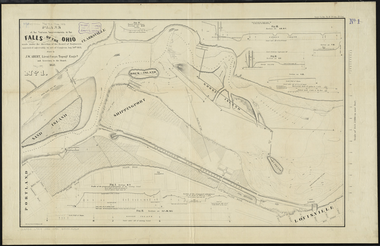
Plans of the Falls of the Ohio
Item Information
- Title:
- Plans of the Falls of the Ohio
- Cartographer:
- United States. Topographical Bureau
- Name on Item:
-
drawn by J.W. Abert, Lieut. Corps Topogl. Engrs. and Secretary to the Board
- Date:
-
1852
- Format:
-
Maps/Atlases
- Location:
-
Boston Public Library
Norman B. Leventhal Map Center - Collection (local):
-
Norman B. Leventhal Map Center Collection
- Subjects:
-
Civil engineering--Falls of the Ohio (Ky. and Ind.)--Maps
Louisville (Ky.)--Maps
Falls of the Ohio (Ky. and Ind.)--Maps
- Places:
-
Jefferson (county)Louisville
Falls of the Ohio
- Extent:
- 4 maps ; 61 x 97 cm. or smaller
- Terms of Use:
-
No known copyright restrictions.
No known restrictions on use.
- Publisher:
-
[Washington, D.C.] :
[Corps Topogl. Engrs.]
- Scale:
-
Scale 1:5,280
- Language:
-
English
- Table of Contents:
-
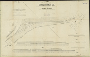
No. 1. Plans of the various improvements at the Falls of the Ohio
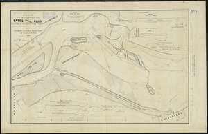
No. 2. Plan of the survey and details of a canal in the Indiana side of the Falls of the Ohio
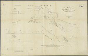
No. 3. [Plan of the canal from Rock Island east, section W-Z]
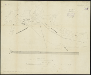
No. 4. Plan of the Louisville and Portland Canal.
- Notes:
-
Relief shown by hachures. Depths shown by isolines.
Oriented with north towards the upper left.
Includes section profiles.
"Senate Ex. Doc. 12. 2d. Sess.32d. Cong."
- Identifier:
-
06_01_003973
06_01_003975
- Call #:
-
G3954.L7N18 1852 .U55
- Barcode:
-
39999065681841

![The rapids of the Ohio commonly called the falls 682 miles below Fort Pitt in 38 [degrees]; 08' no. latitude](https://bpldcassets.blob.core.windows.net/derivatives/metadata/commonwealth-oai:3x81bj69w/image_thumbnail_300.jpg)


