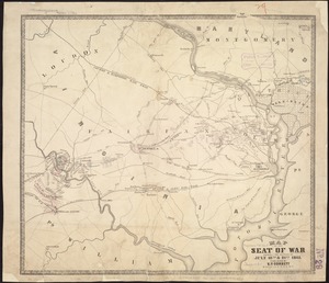
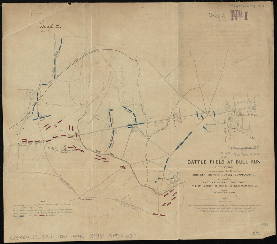
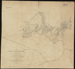
Plan of the battle field at Bull Run, July 21st 1861 : to accompany the report of Brigr. Genl. Irvin McDowell, commanding ; map 1
Item Information
- Title:
- Plan of the battle field at Bull Run, July 21st 1861 : to accompany the report of Brigr. Genl. Irvin McDowell, commanding ; map 1
- Cartographer:
- Whipple, Amiel Weeks, 1817?-1863
- Draftsman:
- Young, J. J.
- Engraver:
- Barnard, W. S.
- Name on Item:
-
prepared by Capt. A.W. Whipple, Topl. Engrs, 1st Lieut. H.L. Abbot Topl. Engrs., 1st Lieut. H.S. Putnam Topl. Eng., drawn by J.J. Young civil engineer ; W.S. Barnard sc.
- Date:
-
[1861?]
- Format:
-
Maps/Atlases
- Location:
-
Boston Public Library
Norman B. Leventhal Map Center - Collection (local):
-
Norman B. Leventhal Map Center Collection
- Subjects:
-
Bull Run, 1st Battle of, Va., 1861--Maps
Landowners--Virginia--Manassas--Maps
Manassas (Va.)--History--Civil War, 1861-1865--Maps
- Places:
-
Manassas (independent city)
- Extent:
- 1 map : color ; 30 x 34 cm
- Terms of Use:
-
No known copyright restrictions.
No known restrictions on use.
- Publisher:
-
[Place of publication not identified] :
[publisher not identified]
- Scale:
-
Scale 1:42,240
- Language:
-
English
- Notes:
-
Shows troop encampments, positions, and movements. Also shows towns, roads, railroads, and names of landowners.
- Identifier:
-
06_01_011013
- Call #:
-
G3884.M25S5 1861 .W45
- Barcode:
-
39999065680371
![Map of the battlefield of Bull Run, Virginia. Brig. Gen. Irvin McDowell commanding the U.S. forces, Gen. [P.] G.T. Beauregard commanding the Confederate forces, July 21st 1861](https://bpldcassets.blob.core.windows.net/derivatives/images/commonwealth:ww72bp023/image_thumbnail_300.jpg)