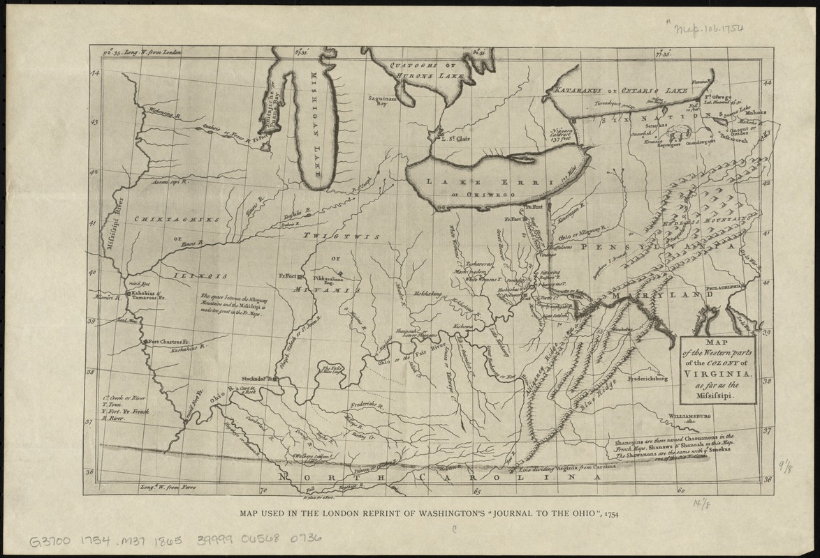
Map of the western parts of the colony of Virginia, as far as the Mississipi
Item Information
- Title:
- Map of the western parts of the colony of Virginia, as far as the Mississipi
- Date:
-
[1865?]
- Format:
-
Maps/Atlases
- Location:
-
Boston Public Library
Norman B. Leventhal Map Center - Collection (local):
-
Norman B. Leventhal Map Center Collection
- Subjects:
-
Washington's Expedition to the Ohio, 1st, 1753-1754--Maps--Early works to 1800--Facsimiles
Indians of North America--Maps--Facsimiles
Manuscript maps--Facsimiles
Early maps--Facsimiles
United States--Maps--Early works to 1800--Facsimiles
Virginia--Maps--Early works to 1800--Facsimiles
- Places:
-
Virginia
- Extent:
- 1 map ; 24 x 36 cm.
- Terms of Use:
-
No known copyright restrictions.
No known restrictions on use.
- Publisher:
-
New York? :
J. Sabin?
- Scale:
-
Scale [ca. 1:4,300,000]
- Language:
-
English
- Notes:
-
Relief shown pictorially.
Prime meridians: London and Ferro.
In lower margin: Map used in the London reprint of Washington's "Journal to the Ohio", 1754.
- Identifier:
-
06_01_010981
- Call #:
-
G3700 1754 .M37 1865
- Barcode:
-
39999065680736