Map of North Carolina
Item Information
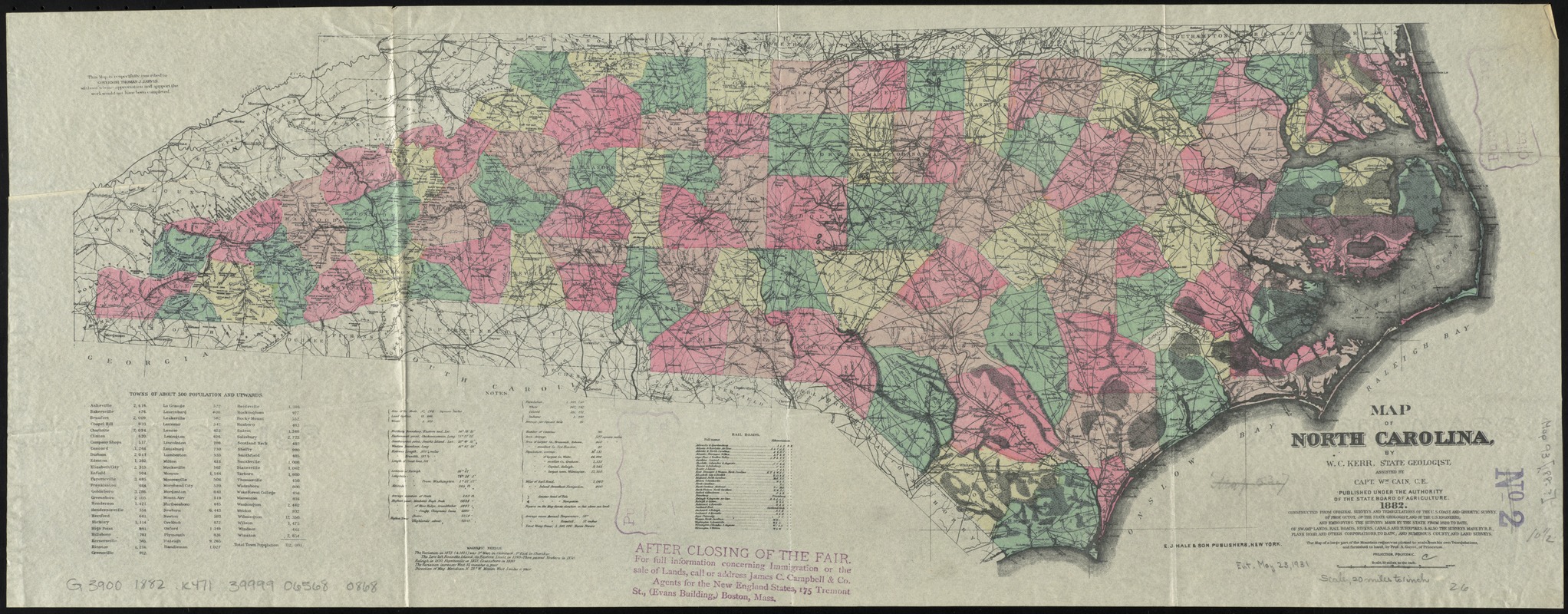
- Title:
- Map of North Carolina
- Creator:
- Kerr, Washington Caruthers, 1827-1885
- Name on Item:
-
by W.C. Kerr, state geologist, assisted by Capt. Wm. Cain, c.e.
- Date:
-
1882
- Format:
-
Maps/Atlases
- Location:
-
Boston Public Library
Norman B. Leventhal Map Center - Collection (local):
-
Norman B. Leventhal Map Center Collection
- Subjects:
-
North Carolina--Maps
- Places:
-
North Carolina
- Extent:
- 1 map : col. ; 28 x 71 cm.
- Terms of Use:
-
No known copyright restrictions.
No known restrictions on use.
- Publisher:
-
New York :
E.J. Hale & Son Publisher
- Scale:
-
Scale [ca. 1:1,267,200] ;
- Language:
-
English
- Notes:
-
Constructed from original surveys and triangulations of the U.S. Coast and Geodetic Survey of Prof. Guyot, of the state geologist, and of the engineers, and embodying the surveys made by the state from 1820 to date, of swamp lands, rail roads, rivers, canals and turnpikes, and also the surveys, made by R.R., plank road, and other corporations, to date, and numerous county and land surveys.
Includes population chart of towns of about 500 and upwards, cartographic notes, and railroads.
"Published under the authority of the State Board of Agriculture."
"This map is respectfully inscribed to Governor Thomas J. Jarvis, without whose appreciation and support the work would not have been completed."
Scale given as 10 miles to the inch on the original map.
- Identifier:
-
06_01_010970
- Call #:
-
G3900 1882 .K471
- Barcode:
-
39999065680868


