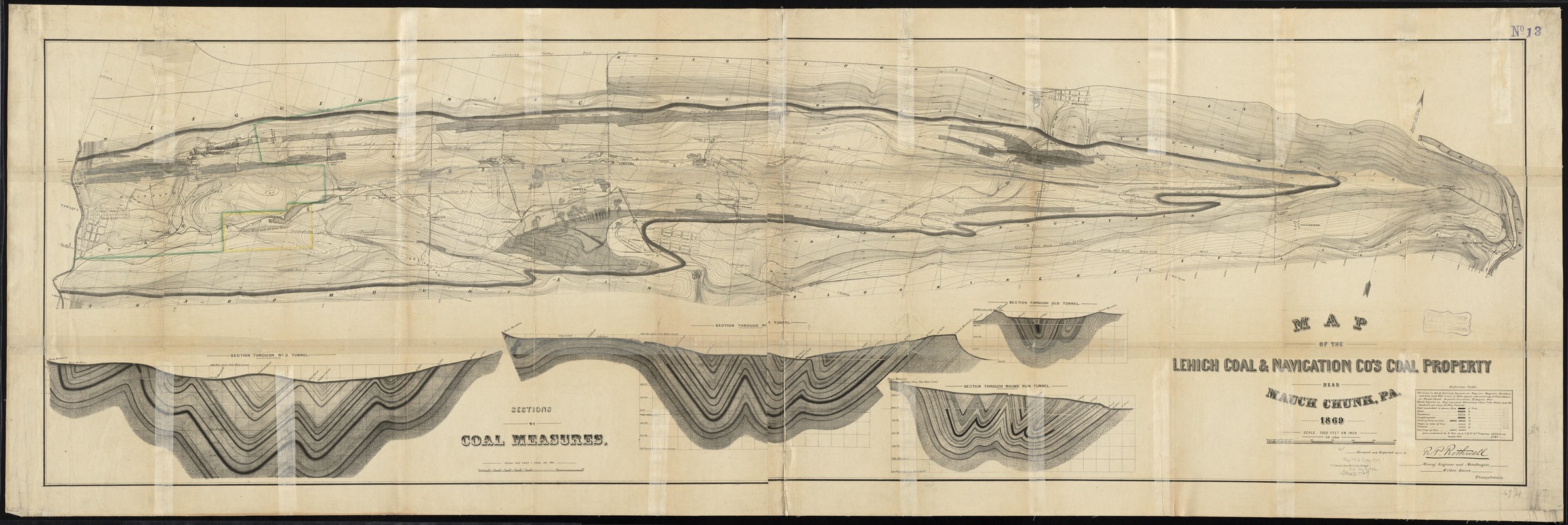
Map of the Lehigh Coal & Navigation Co.'s coal property near Mauch Chunk, Pa
Item Information
- Title:
- Map of the Lehigh Coal & Navigation Co.'s coal property near Mauch Chunk, Pa
- Creator:
- Rothwell, Richard P. (Richard Pennefather), 1836-1901
- Name on Item:
-
surveyed and reported upon by R.P. Rothwell, mining engineer and metallurgist, Wilkes-Barre, Pennsylvania.
- Date:
-
1869
- Format:
-
Maps/Atlases
- Location:
-
Boston Public Library
Norman B. Leventhal Map Center - Collection (local):
-
Norman B. Leventhal Map Center Collection
- Subjects:
-
Lehigh Coal and Navigation Company
Coal mines and mining--Pennsylvania--Carbon County--Maps
Mines and mineral resources--Pennsylvania--Carbon County--Maps
Carbon County (Pa.)--Maps
Mauch Chunk (Pa.)--Maps
- Places:
-
Carbon (county)Jim Thorpe
- Extent:
- 1 map ; 54 x 181 cm.
- Terms of Use:
-
No known copyright restrictions.
No known restrictions on use.
- Publisher:
-
Philadelphia [Pa.] :
P.S. Duval, Son & Co.
- Scale:
-
Scale 1:12,000. 1000 feet an inch
- Language:
-
English
- Notes:
-
Relief shown by contours.
Oriented with north towards the upper right.
Insets: Four sections of coal measures -- Scale 1:4800 (400 feet one inch).
- Identifier:
-
06_01_010932
- Call #:
-
G3823.C36H9 1869 .R68
- Barcode:
-
39999065679381