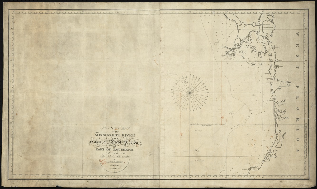
A new chart of the Mississippi River, the coast of west Florida, and part of Louisiana
Item Information
- Title:
- A new chart of the Mississippi River, the coast of west Florida, and part of Louisiana
- Creator:
- Lambert, Samuel, 1768-1832
- Name on Item:
-
drawn from the latest authorities by Samuel Lambert.
- Date:
-
1821
- Format:
-
Maps/Atlases
- Location:
-
Boston Public Library
Norman B. Leventhal Map Center - Collection (local):
-
Norman B. Leventhal Map Center Collection
- Subjects:
-
Nautical charts--Mexico, Gulf of
Gulf Coast (Ala.)--Maps
Gulf Coast (Fla.)--Maps
Gulf Coast (La.)--Maps
Gulf Coast (Miss.)--Maps
Mississippi River--Maps
- Places:
-
Mississippi River
Mexico, Gulf of
- Extent:
- 1 map ; 51 x 91 cm.
- Terms of Use:
-
No known copyright restrictions.
No known restrictions on use.
- Publisher:
-
Salem :
Samuel Lambert
- Scale:
-
Scale [ca. 1:852,000]
- Language:
-
English
- Notes:
-
Oriented with north to the right.
Depths shown by soundings.
Covers the Gulf Coast from New Orleans to Saint Joseph Bay.
"Entered according to act of Congress Sept. 1st, 1821 by Cushing & Appleton and S. Lambert of the State of Massachusetts."
- Identifier:
-
06_01_010853
- Call #:
-
G4042.M5P5 1821 .L36
- Barcode:
-
39999065678219