Citizens & travelers guide map in, to and from the city of New York and adjacent places
Item Information
- Title:
- Citizens & travelers guide map in, to and from the city of New York and adjacent places
- Title (alt.):
-
Citizens and travelers guide map in, to and from the city of New York and adjacent places
- Description:
-
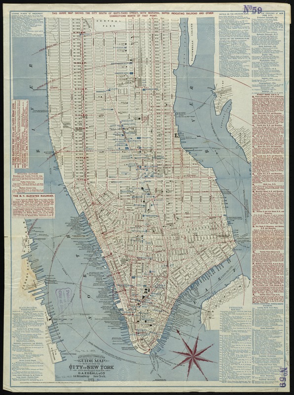
Covers Manhattan south of 63rd St.
- Creator:
- D.A. Edsall & Co
- Date:
-
1877
- Format:
-
Maps/Atlases
- Location:
-
Boston Public Library
Norman B. Leventhal Map Center - Collection (local):
-
Norman B. Leventhal Map Center Collection
- Subjects:
-
Manhattan (New York, N.Y.)--Maps
New York (N.Y.)--Maps
- Places:
-
New YorkManhattan
- Extent:
- 1 map : col. ; 67 x 49 cm.
- Terms of Use:
-
No known copyright restrictions.
No known restrictions on use.
- Publisher:
-
New York :
D.A. Edsall & Co.
- Scale:
-
Scale [ca. 1:14,000]
- Language:
-
English
- Notes:
-
Oriented with north to the upper left.
Shows radial distances from City Hall and ferry routes to New Jersey, Queens, and Brooklyn.
Includes lists of railroads, ferries, steamship lines, stagecoach lines, street horse car lines, hotels, churches and places of amusement.
- Identifier:
-
06_01_010812
- Call #:
-
G3804.N4:2M3 1877 .D34
- Barcode:
-
39999065678649


