Map of New York and vicinity
Item Information
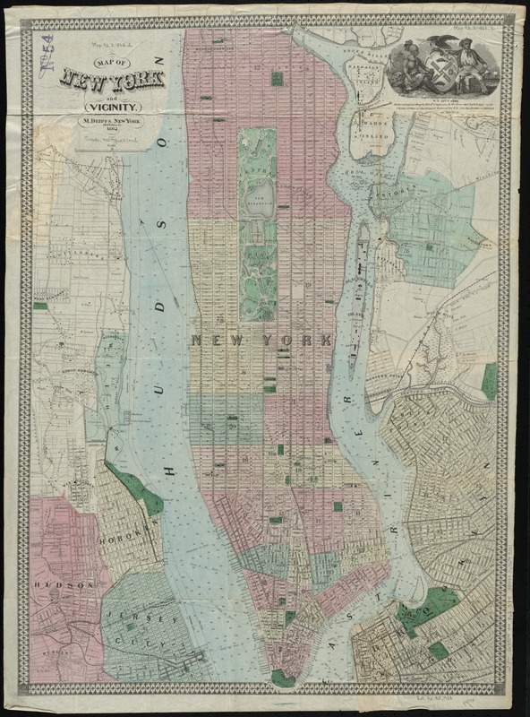
- Title:
- Map of New York and vicinity
- Creator:
- Dripps, M. (Matthew)
- Date:
-
1862
- Format:
-
Maps/Atlases
- Location:
-
Boston Public Library
Norman B. Leventhal Map Center - Collection (local):
-
Norman B. Leventhal Map Center Collection
- Subjects:
-
Manhattan (New York, N.Y.)--Maps
Brooklyn (New York, N.Y.)--Maps
Hoboken (N.J.)--Maps
Jersey City (N.J.)--Maps
Manhattan (New York, N.Y.)--Administrative and political divisions--Maps
New York (N.Y.)--Maps
- Places:
-
New YorkBrooklyn
Hudson (county)Hoboken
Hudson (county)Jersey City
New YorkManhattan
- Extent:
- 1 map : hand col. ; 65 x 45 cm.
- Terms of Use:
-
No known copyright restrictions.
No known restrictions on use.
- Publisher:
-
New York :
M. Dripps
- Scale:
-
Scale [ca. 1:23,000]
- Language:
-
English
- Notes:
-
Shows streets, wards, ferry lines and portions of adjoining cities.
"Entered according to act of Congress in the year 1862 by M. Dripps in the Clerk's Office of the District Court for the Southern District of New York."
- Identifier:
-
06_01_010804
- Call #:
-
G3804.N4 1862 .D75
- Barcode:
-
39999065679001


