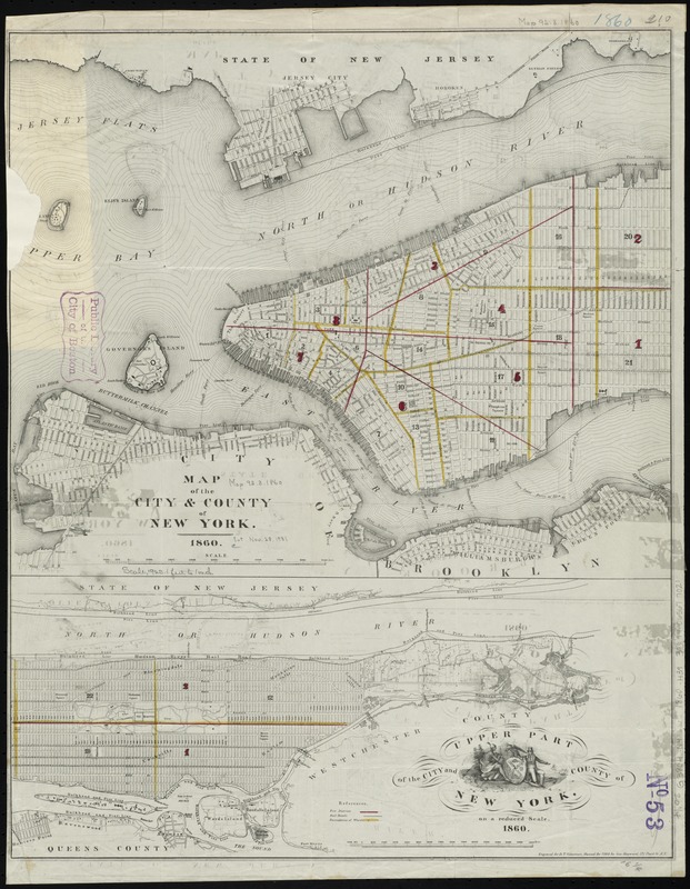
Map of the city & county of New York ; Upper part of the city and county of New York on a reduced scale
Item Information
- Title:
- Map of the city & county of New York ; Upper part of the city and county of New York on a reduced scale
- Title (alt.):
-
Map of the city and county of New York
- Creator:
- Hayward, George, approximately 1800-
- Name on Item:
-
engraved for D.T. Valentine's Manual for 1860 by Geo. Hayward.
- Date:
-
1860
- Format:
-
Maps/Atlases
- Location:
-
Boston Public Library
Norman B. Leventhal Map Center - Collection (local):
-
Norman B. Leventhal Map Center Collection
- Subjects:
-
Manhattan (New York, N.Y.)--Maps
New York (N.Y.)--Maps
- Places:
-
New YorkNew YorkManhattan
- Extent:
- 2 maps on 1 sheet : hand col. ; 34 x 41 cm. and 18 x 41 cm., on sheet 55 x 43 cm.
- Terms of Use:
-
No known copyright restrictions.
No known restrictions on use.
- Publisher:
-
New York :
[Common Council]
- Scale:
-
Scale [ca. 1:22,200]
Scale [ca. 1:42,400]
- Language:
-
English
- Notes:
-
Shows railroads, ward boundaries, pier and bulkhead lines, and fire districts.
Oriented with north toward the upper right.
Includes ill.
- Identifier:
-
06_01_010806
- Call #:
-
G3804.N4:2M3 1860 .H39
- Barcode:
-
39999065677021


